
Summit Elevation (m): 2810
Trip Date: Sunday, June 24, 2018
Elevation Gain (m): 2000
Round Trip Time (hr): 12
Total Trip Distance (km): 42
Quick ‘n Dirty Rating: Class 3 – you fall, you break your leg
Difficulty Notes: While there’s no technical terrain on our route, there is very steep, vegetated slopes which are exposed to cliffs below. Remote peak with unbridged stream crossings.
Technical Rating: SC6; RE4
GPS Track: Gaia
Map: Google Maps
After our trip up Mount Morrison and Owl Peak earlier in the week, Phil and I had been thinking (obsessing) about its supposedly easy neighbor to the south – Mount Currie. This might seem strange to some folks, but Phil and I don’t just love peakbagging, we love getting to peaks that are not done very often and are remote and somewhat challenging to access. For us it’s about the backcountry experience as much as the summit. Lucky for us, Mount Currie happened to have a bit of everything that we love including a bike approach, hiking along a scenic river with ever diminishing trails, wild creek crossings and some pretty remote wilderness. We were also the 4th or 5th recorded ascent party in the last 31 years to sign the register, so even though the peak is technically quite easy and apparently even visible from the Spray Lakes road, it’s remoteness and relative obscurity have resulted in only a few ascents.
My day started out on a very familiar theme from waking up at 04:40 to driving to the Shark Mountain trailhead and biking the ~5km to the start of the Spray River Valley trail along the Bryant Creek trail. From here we followed the now-familiar trail through soaking wet undergrowth to the White Man Pass branch before taking this much less traveled option – just as we had days previous for Mount Morrison. The morning was a beauty. Fog was lifting off the vegetation and valley bottoms, thanks to copious amounts of rain in the previous few days.

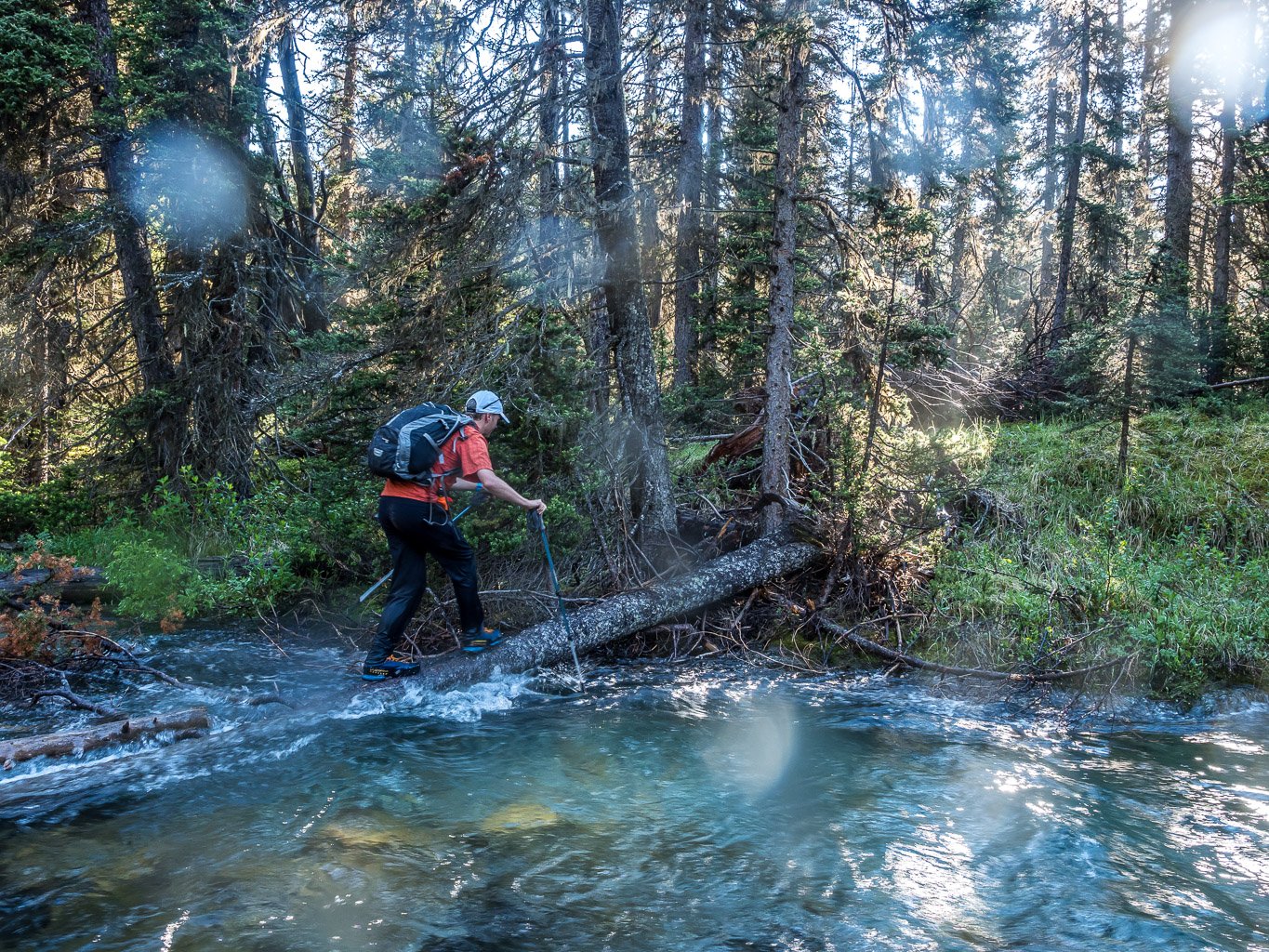
The first bridge across Spray River was surrounded by the flooding river and would have required getting our feet wet if we needed to cross it – which we didn’t. Alas, within a few minutes of continuing past our turnoff from a few days previous at the ancient Currie Creek “trail” which is now obviously not in use anymore, we realized we’d be getting very wet soon. Currie Creek itself was far from being decommissioned! We could hear its roar from afar, and only then did we start wondering about the crossing. When I saw the crossing spot on Currie Creek I was worried. The water was fast and deep here – obviously this is an original horse crossing area rather than a hikers crossing. I started across but at almost the crotch deep point with a strong current, I turned back and mentioned we should find a better crossing spot. We bushwhacked upstream for a few hundred meters before finding a spot that “worked”. It was far from perfect as we had to get onto a slick log just as the stream got deeper and balance the rest of the way to the far shore! We didn’t even bother taking our approach shoes off for the crossing – simply thrashing right through the water – I love warm summer tripping! Phil lost his sunglasses while balancing along the log, but we survived and thrashed our way quickly back to the White Man Pass trail. I was thinking we’d have to do better on return as the creek was likely to be no lower.
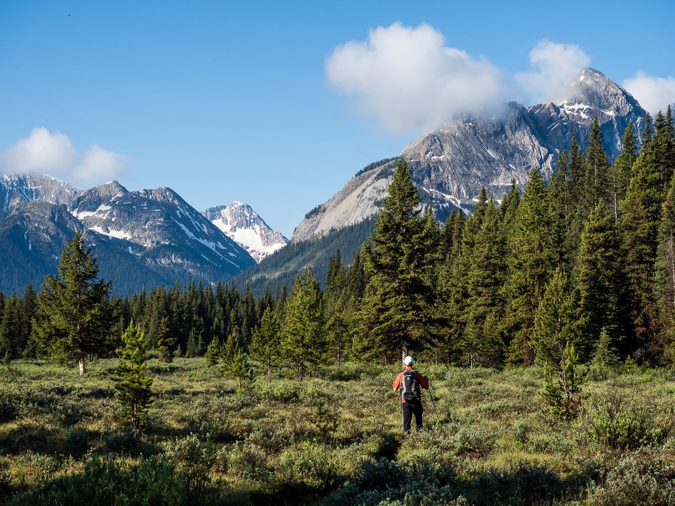
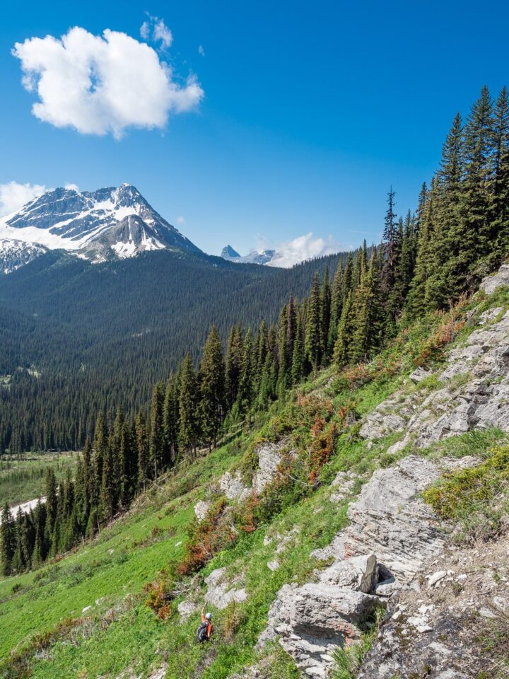
From Currie Creek to the avalanche paths on the SE side of Mount Currie the trail was delightful – even though the vegetation was saturated, we were soaked from the crossing anyway and didn’t mind much. Mosquitoes were nonexistent to my surprise and once again we were serenaded by a chorus of forest birds. We had moose and bear tracks on our trail which was contributed to the feeling we were slowly immersing into wilderness again. About 3 hours after leaving the parking lot we were finally thrashing our way through low, soaking wet vegetation on the south side of Mount Currie, looking up at some pretty impressive avalanche slopes above. We were still on trail, but the trail is buried in the shrubs here. After 10 minutes or so we decided to start up the nearest avy path with the intention to traverse further to the west to easier looking lines up the slopes there (things looked pretty slabby on the east side of the south face).

The hiking started out easy (doesn’t it always?) and soon we were traversing left (west) along wet, slick grass and carpets of wildflowers. The strong smell of avy debris hung in the now-humid morning air as fog and mist lifted out of the valley below. There wasn’t a breath of wind and we were soon sweating profusely as the slope angle steepened quickly. As we grunted and ground our way upward, I noticed a shiny pink out-of-place shape to my left in some low bushes. We traversed over to it and to our dismay it was a mylar Happy Mother’s Day balloon!! Can you believe that? Way out here, in the middle of nowhere someone’s silly balloon had drifted from who-knows-where to lodge itself in a Kruppelholz tree on our avalanche slope. Crazy. Almost as bad as whatever the garbage was on the summit of Breaker Mountain. We really are polluting every square inch of our planet! I have no doubt that the planet will defeat us humans in the end, but it’s gonna take a few million years for all our damn mylar balloons to fully disintegrate.
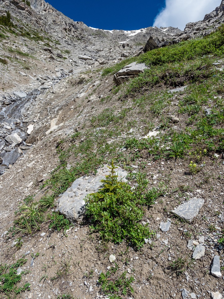
From the mylar balloon things got a bit more interesting than they needed to on hindsight. We started ascending some easy looking slabs above the grassy slopes (we were tired of traversing them on our approach shoes) and immediately regretted it. We’re idiots, so we spent time searching for easier lines but eventually we gave up and descended back to the slippery traverse – aiming for a gully just east of the south ridge. Eventually we reached the gully, which looked a bit intimidating from below to be honest. The first part looked reasonable enough, if not dead easy, but the top part looked like it could get a bit tougher. We briefly considered traversing even further, to the south ridge, but decided we were sick of traversing and started straight up instead.
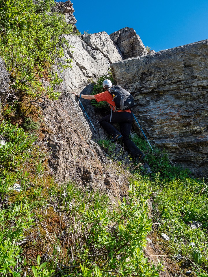
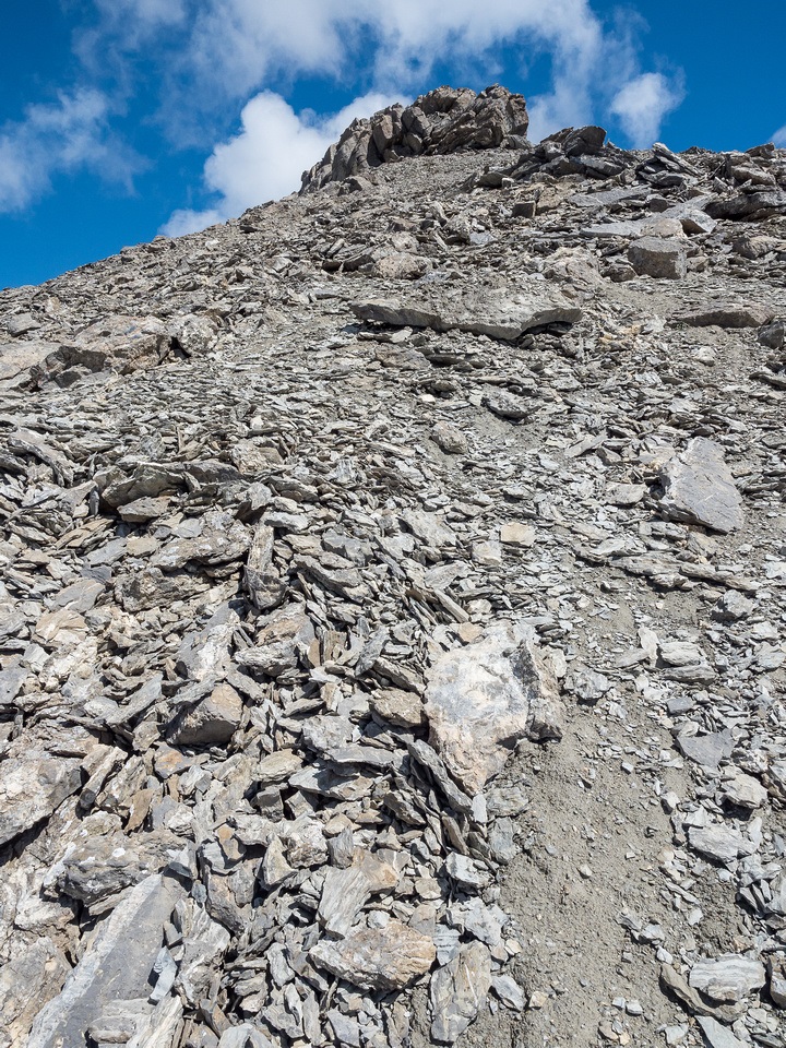
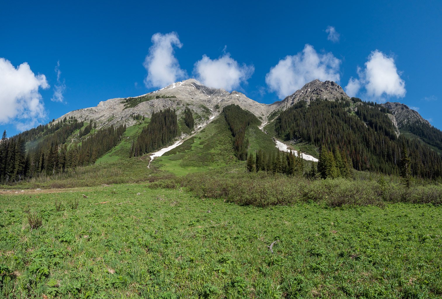
The gully worked perfectly and despite being steep it remained easy scrambling. Even the top of the gully was pretty easy and soon we were navigating around and on top of the south ridge to the summit. We detoured the west side of the summit block before ascending easy, blocky scree to the apex of Mount Currie. The views were pretty stunning from this peak – especially looking towards White and Red Man Mountains and towards Warre and Vavasour.

The Assiniboine region was scenic but unfortunately Mount Assiniboine and Eon were covered in clouds – no matter since we’d seen them from a better angle only 4 days previous from Mount Morrison. The best views towards the Assiniboine area were over Currie Creek towards an easy looking Mount Byng and some of Red Man’s outliers near the head of the remote Currie Creek Valley. It made me wonder if following that old, decommissioned trail up Currie Creek might be a worthwhile adventure some day? I guarantee you that valley doesn’t see many humans anymore. There’s simply no way to access it easily.


As we exited the south face to the south ridge, the views to the west were stunning. I couldn’t help but notice a very aesthetic line down the west face of Currie to a prominent ridge running south towards White Man Pass. I immediately mentioned to Phil that we should considering adding this traverse to our day. In typical Phil fashion, his response was also immediate – “why wouldn’t we do that”? So we did.
Great Adventure! And even better photos, well done.
Heading into this region this Summer, to touch some of the history and soak up the beauty of the area.