
Summit Elevation (m): 2358
Trip Date: Saturday, May 11, 2019
Elevation Gain (m): 1350
Round Trip Time (hr): 8.5
Total Trip Distance (km): 12
Quick ‘n Dirty Rating: Class 2/3 – you fall, you sprain or break something
Difficulty Notes: A much longer day than you’d think given the stats. This is essentially one long bushwhack of varying difficulty – even on the ridge. With snow route finding becomes more challenging.
Technical Rating: SC6; RE3/4
GPS Track: Gaia
Map: Google Maps
As the weekend approached, Phil Richards and I were getting a wee bit desperate to find a peak that didn’t involve obvious avalanche hazards or post-holing hell. We avoided any avalanche terrain, but unfortunately we did not avoid post-holing. Phil noticed from a friends photos that the low mountains around Radium Hot Springs looked pretty dry. At first he suggested Redstreak Mountain but on further analysis we realized it was likely still too snowy. After doing some more browsing we found two trip reports for Mount Berland – located just across hwy 93 from Redstreak – from Sonny and Josee. Considering a south facing ridge we were pretty sure it would be dry enough. A last minute snowy update from Bill and Kev who’d turned back on their objective in the same area had me doubting again but looking at the same traffic camera that had suckered Sonny in 2014, convinced me to just go for it.

I was up at 04:45 and at Phil’s Canmore residence by 06:30. Phil drove to the trailhead on a gorgeous morning that felt more “summer” than “spring”. We saw 3 black bears, a gorgeous red fox and numerous deer and elk on our early morning drive up the Banff-Windermere hwy (93). We noted all the snow on the surrounding peaks – despite the warm temperatures the conditions looked more like deep winter than mid spring. After passing numerous closed trails (active bears in area) we were relieved to see no tape blocking the small pull-off area just before Radium Hot Springs and our trailhead. The morning was gorgeously warm already at 08:30 and birds serenaded us cheerfully as we started up a small clearing from the highway.

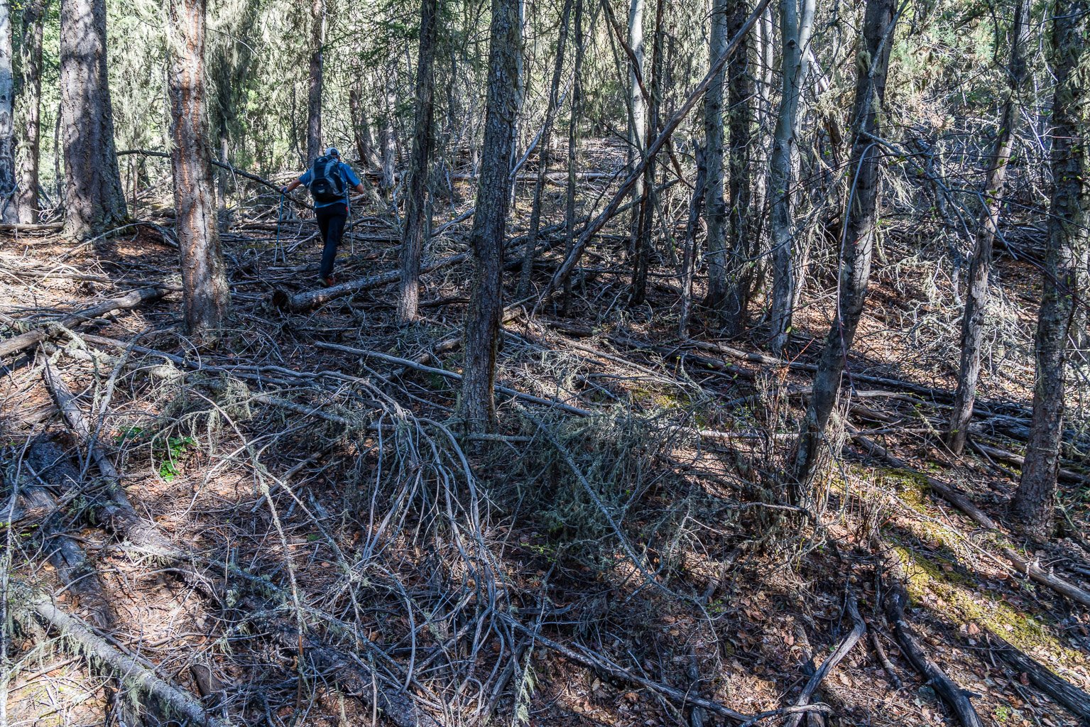
At the end of the clearing our work started in earnest. We plunged into “light” forest on our right and started up the steep slopes hoping to hit the ridge proper above to our right. Both Sonny and Josee had mentioned pretty tame bushwhacking, so we were a bit taken aback by thicker strands of matchstick trees and deadfall on our steep, sweaty ascent of the relentless steep SE ridge. On hindsight while the bush is certainly very light by BC standards, it’s pretty normal for AB scramblers. In other words, it was pleasant for some of the time and extremely unpleasant for others. And it was bloody steep too! In typical BC fashion, we ended up spending most of our day in trees – even near the summit.

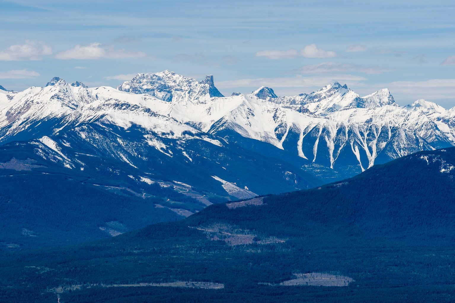
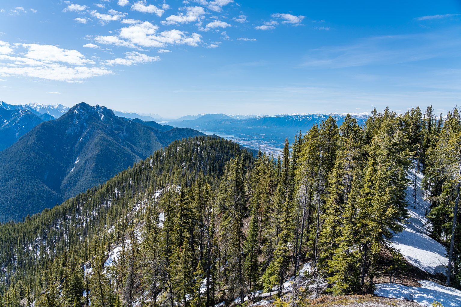
As we slowly made our way up the SE ridge we eventually curved left along its crest until we were heading due west to intersect Berland’s south ridge and the first high point with good views. As we ascended this slope we were surprised by a rocky cliff band in the forest. Moderate scrambling brought us up this obstacle and soon we were topping out to our first decent views of the day – and as it turned out, among the best views! It took us about 2 hours to this point – 500m per hour is some steep hiking! It was a lovely day, with very warm sunshine and very happy sounding birds all around us. The Columbia River Valley was green and vibrant below us to the west, while the Purcell and Kootenay mountains still looked locked in their winter coats. We were absolutely delighted with the seemingly dry south ridge stretching out in front of us and after a brief break we started along it.


Almost immediately we realized that the south ridge wasn’t going to be quite as pleasant as we first thought. The words “Lusk Ridge” were thrown around for the next few hours – and not necessarily in a good way. Before you get the wrong impression of our day, let me preface the whining with the good stuff. It was a very pleasant, warm, sunny Spring day with lots of chirping birds and good laughs and conversation. The strong smell of Pine trees filled our nostrils and the feel of warm rock relaxed our minds and made us long for more summer days ahead. It was long overdue and frankly my whole body seemed to absorb the atmosphere in a huge collective sigh of relief that the long days of summer and explor8ion were finally just ahead of us again. So that was awesome. Now for the chapter on suffering.

Re-reading Sonny’s trip report I realize that in my haste and longing to enjoy a warm day on as little snow as possible, I glossed over some of the finer details of his tome. That negligence bit me in the keister a bit. We had almost an identical experience to his – albeit with less snow and more delightfully dry rock. But still way more snow than it appeared at first and way less than Josee. I can’t relate to Josee’s report. Her time of 8 hours on snowshoes with copious amounts of snow is very impressive. The only way I could imagine her speed is if the snow somehow made the terrain along the south ridge easier and less complex which seem counterintuitive but isn’t outside the realm of possibility.


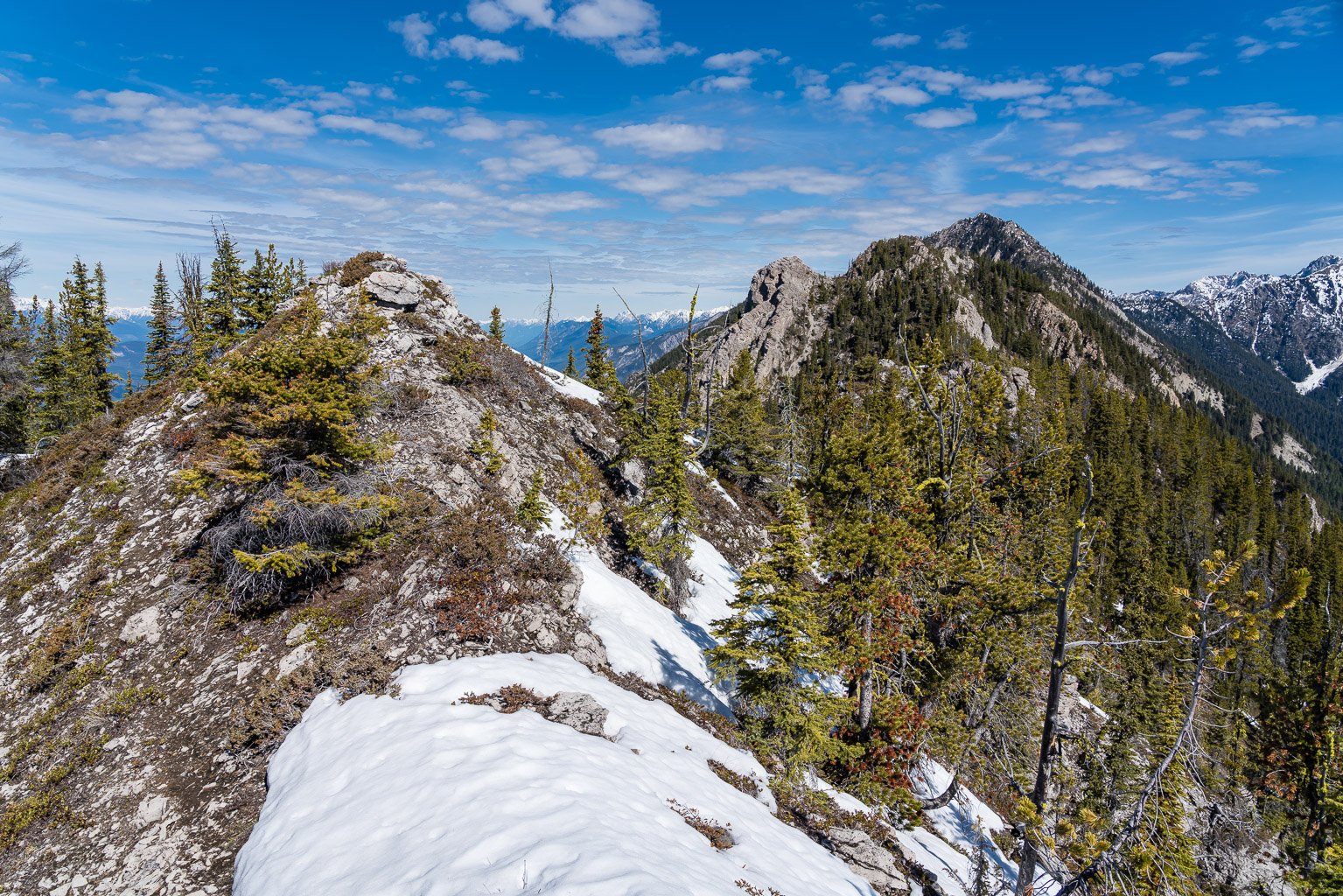
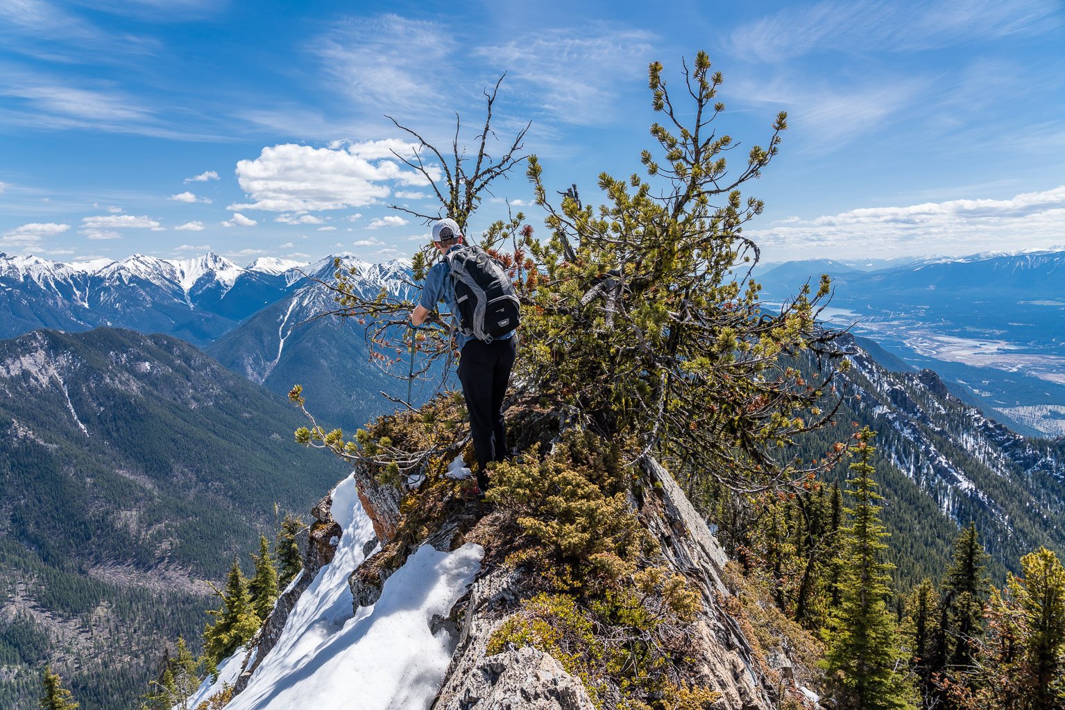
The entire south ridge of Mount Berland from the first false summit to the true summit was a bit convoluted, snowy, icy, treed and somewhat exposed in spots. My poor arms and legs were scratched up afterward like I did battle with some very stubborn trees – and lost. There was way more snow than first appeared. Up to waist deep for short sections. There were a few fun, moderate sections of dry rock, including one exposed ridge with a darn stubborn tree blocking the way. Snow and ice made things more complicated, especially the few times we dipped to our left (west) to avoid difficult scrambling on the ridge proper. The ridge seemed to never end and even when we thought we were there we weren’t. Finally around 2.5 hours after leaving the first false summit we were standing on Mount Berland’s highest point.

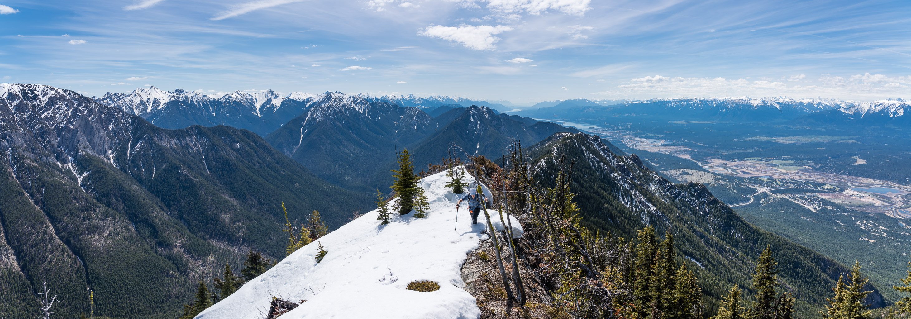
Views were much better than I was expecting on such a lowly peak, especially across the Columbia Valley to the Purcell and Columbia Ranges to the west including giants such as Delphine and Farnham. We were surprised to be the first signatures in the summit register in 4 years.


Considering that this is one of only a few named summits rising directly over the mountain towns of Radium and Edgewater, I expected more action but on hindsight I think most people attempting this peak would end up turning around at some point along the exhausting ridge. We didn’t see (m)any signs of human activity along the entire route with no trails in the forest (other than sparse animal trails) and no cairns or flagging along the ridge either.


After a brief break on the summit we turned to the long trek back. Ironically we were sweating profusely from our ankles up but our feet were frozen solid. We were wearing approach shoes in anticipation of a light and fast day and I don’t think my toes have been that cold for many years – including many trips to the Columbia Icefield in winter conditions. I couldn’t even feel my toes for half the ridge back thanks to the slurpee snow we were wading through along it! Eventually the heat won and my toes were thawed.

I was really feeling the heat by the time we finally descended back to the SE ridge. The 900 vertical meters of loss was hard on the knees but we managed to find some sandy terrain closer to the gully between the SE and South ridges that assisted us greatly. To be honest, I’m not sure why we didn’t just stick in the gully all the way down, but I remembered that Josee avoided it for some reason, so we eventually traversed back to the SE ridge and finished our descent in the forest.
A great day out when options were very limited due to a big, late snowpack in the Rockies. Berland will never be popular unless they build a gondola to its summit but it does present a decent option for scramblers looking to escape a deep snowpack everywhere else and desiring a unique summit that doesn’t have 8 million ascents (ala Heart or Yamnuska Mountain). Put another way – it sure as heck beat a lovely day spent on the couch at home.
Thanks for the report and especially the great photos. I’ve been looking at Berland from our cabin north of Edgewater for 45 years. Never climbed it but wondered what it looks like from the top. Thanks for sharing the adventure. Curious, why tackle the ridge from Radium? Did you consider ascending from the north east?
Hey Paul, honestly the only reason we tackled Berland from Radium is because we drove from Calgary and the NE aspect would have had more snow.