
Summit Elevation (m): 3000
Trip Date: August 14, 2025
Elevation Gain (m): 1700
Round Trip Time (hrs): 12
Total Trip Distance (km): 33.5
Quick ‘n Dirty Rating: Class 3/4 – you fall, you break something or die
Difficulty Notes: Difficult, exposed and loose scrambling on the route I took. I’m not convinced there’s much easier ones.
Technical Rating: SC7-
GPS Track: Gaia
Map: Google Maps
“Oof that’s an awful one, you’ll love it” was Devan’s response to me telling him I was planning to ascend Mount Beatty on August 14th 2025. With those inspiring words, what choice did I have? More than a few years ago, on July 26, 1999 Rick Collier and Mardy Roberts ascended Mount Beatty from the east via a previously undocumented route. Rick rated their scramble as “moderate with exposure”. Reading a comment below his trip report on bivouac.com is amusing,
The author is correct that the snow on the east face disappears. As of August 14, 2007 the face was bare. Underneath the snow is some very rotten rock, more akin to pea-gravel and dirt… not fun to ascend as we turned back half way up.
This opinion from 2007 was echoed by Devan Peterson who followed the same route only last year, commenting that,
I suppose a 3rd class line exists but not sure how you rate steep dirt. I’d consider it 4th class, 5th if you gain the ridge too early.
All of these ringing endorsements were nothing more than a siren call for someone like myself who likes obscure, manky routes up relatively unspectacular peaks, for unknown and more accurately, undiagnosed reasons. To make my day more “fun” I decided to follow Devan’s track up nearby “Beatty Bump” and “Razor Flakes” peak which was rumored to be only 2nd class terrain from the Beatty col. Unfortunately this rumor came from David Jones “Rockies South” (pg. 192) and could mean anything from hands-in-pockets hiking to near free soloing so that was exciting too. All in all this was promising to be one of those choose-my-own-adventure type trips that I tend to enjoy.

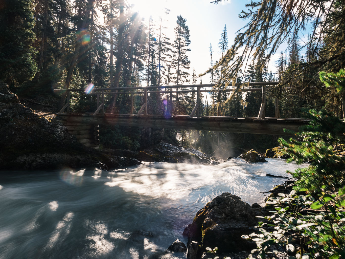
I left the Interlakes parking lot at 08:00 on my bike, knowing that despite today’s goals it wasn’t going to be drastically long either. Most of my approach and egress would be on established trails and the weather forecast was improving throughout the day so no need to get up at 03:30 for once. The first 4km were their usual bumpy and somewhat grumpy selves. I always forget how rough this first section is on the bike – especially when it crosses rubble slopes south of Mount Indefatigable. After locking the bike to a nearby tree I continued up the excellent trail towards Forks Campground. Birds were chirping and I was happy as I tramped through the forest for an hour towards the camp.

As I turned off the main track, heading north up the Maude-Lawson Trail, I was following a large group of 8 backpackers presumably just starting out from Forks. There seems to be a lot of grizzlies out this year so I didn’t mind all the human activity on the trail today. I’d met two young gentlemen earlier who’d warned me of a grizzly encounter coming down from Three Isle Lake, so I was aware of at least one bruin in the vicinity.


I quickly passed the large group and found myself alone on the trail again as it followed the Upper Kananaskis River for a short stretch and then started gaining serious height up avalanche slopes east of Mount Putnik. I had fond memories of this trail from over two decades previous when I was last up here, leading a group of school kids on a hike from our base camp at Forks Campground. The sun was warm and I felt great as I continued up switchbacks and through stands of mature forest.


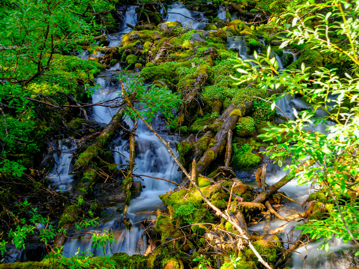
As I crossed a small bridge over a stream coming from dying glaciers to the west, I spotted what I assumed must be Razor Flakes Peak rising through morning clouds ahead. It looked pretty big at this point and I knew I’d be exiting the lovely side valley that the trail skirted past. It’s always interesting to note where you’ll be hours and hours into the future with absolutely no idea how or when you’ll get there!

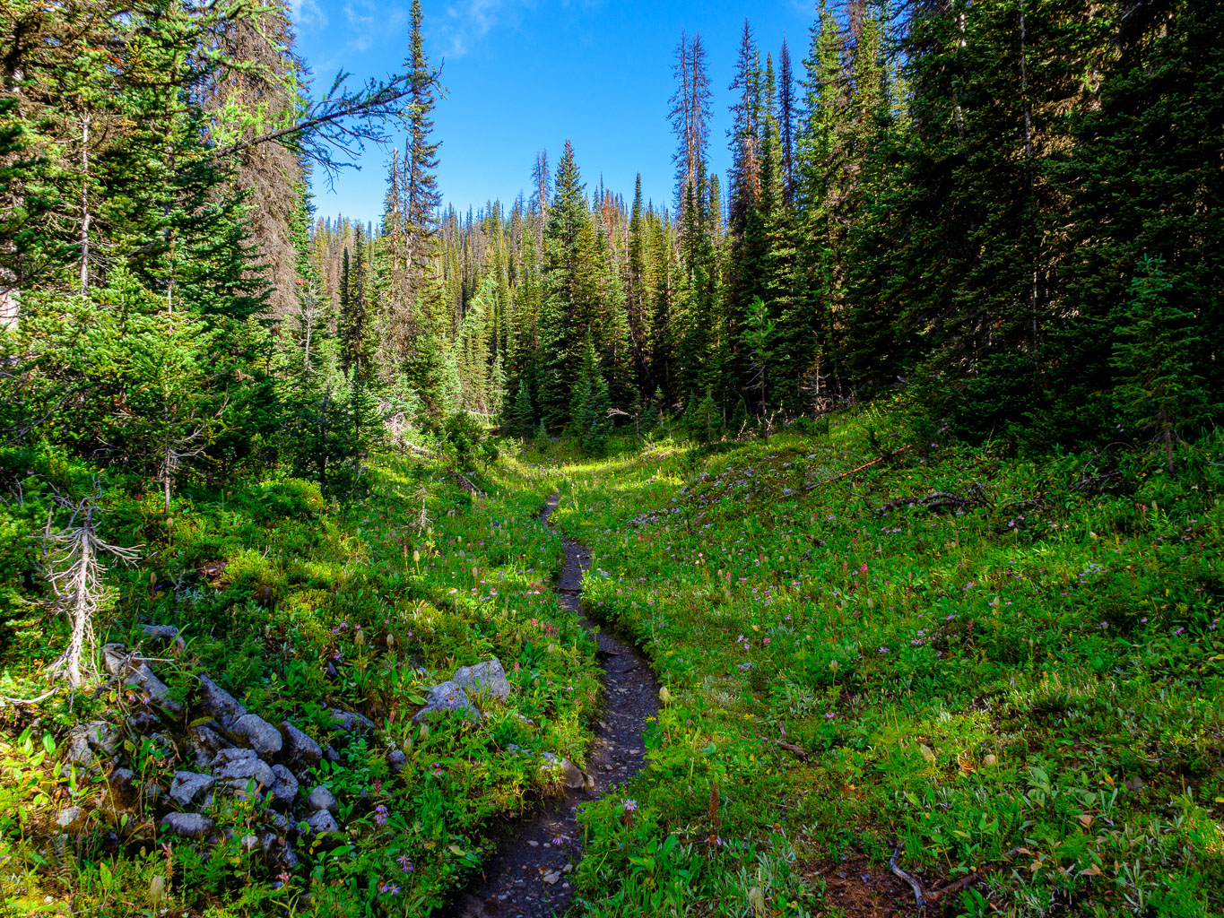
After hiking through lovely little draws with wildflowers and marmots I finally spotted my first lake of the day, fed by the Beatty Glacier to the NW. At this point I should have cut x-country and accessed the glacier directly from my current position. Instead, I convinced myself somehow that I should follow Devan’s approach from Lawson Lake, even though there was no good reason to go that far in my case. Oh well. It worked out OK and before hitting the lake In finally turned west up easy, open scree slopes towards my objective.


I was still muttering to myself, annoyed at hiking too far up the trail as I started up hardpack moraines under Beatty Bump. In the end I actually think my line was optimal – taking the shortcut might have put me on the glacier a little too early. In any case, I now found myself on the worst of Rockies terrain – concrete hard moraine with barely any holds for my feet and the constant threat of a cheese grater experience with a slip. Thankfully this was short-lived and soon I was on easier terrain climber’s right of the small Beatty Glacier.


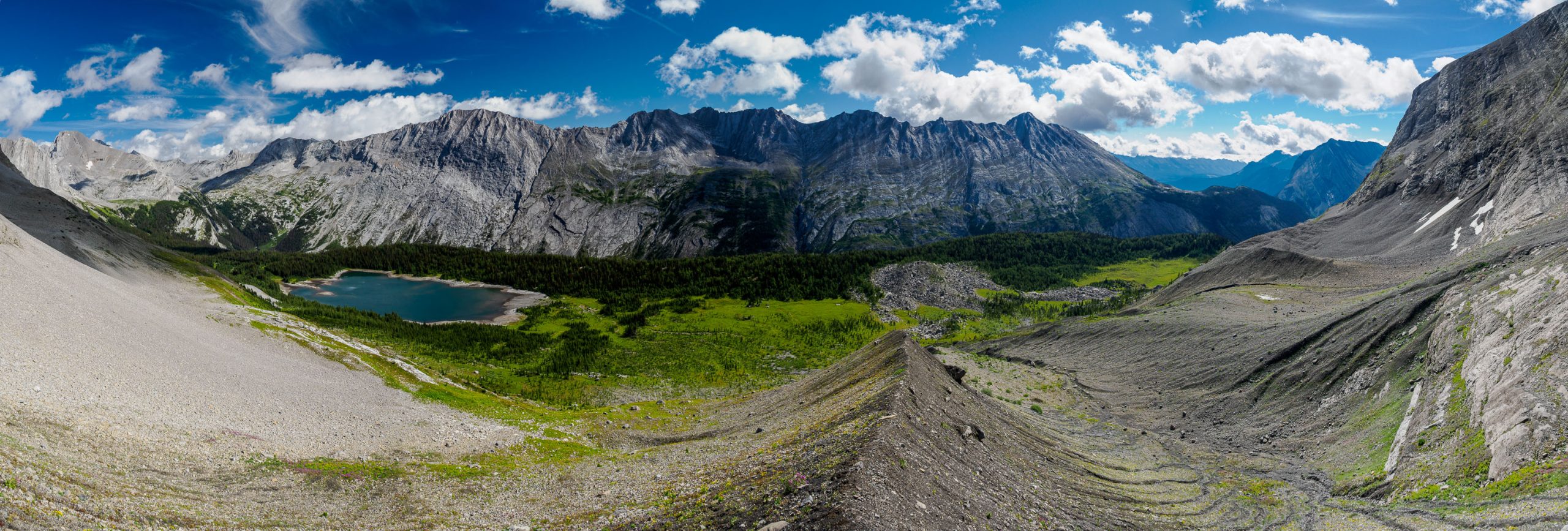

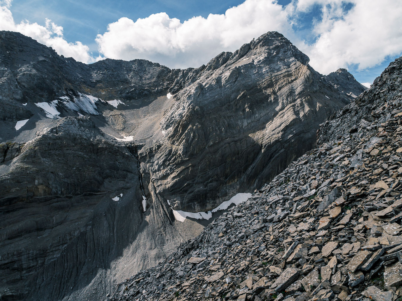
I followed alongside the glacier until realizing I was now on it. Loose boulders and rubble took me to the Beatty / Bump col where I was surprised to see another glacier leading off towards Beatty Bump. Not so surprising was the intimidating views back towards Beatty’s manky looking east face, but that was future Vern’s problem so I ignored it. A short fun trek across a small glacier brought me under Beatty Bump’s west face which was more complex than I was expecting.


Rather than a simple class 2 walk up, there was some easy to moderate scrambling on ledges and steep scree to the broad summit. From there I had to traverse a short way down and over to a subsidiary high point to the east which I hoped would grant good views of Lawson Lake. It didn’t. I did find some human detritus on this slightly lower bump, in the form of slats of wood laying around. I’m not sure what they were used for but obviously someone had been here before.


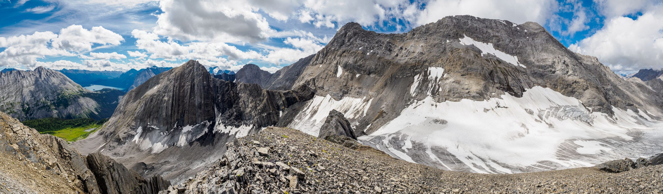

I returned to the bump and proceeded back across the upper glacier towards Beatty’s east face. There was no obvious route up the steep, dirty looking slopes but I knew that if I got my nose into it a path would open up. Indeed. After a short, but somewhat tricky and scary ascent on very steep hardpack dirt with embedded (but still loose) rocks and boulders for footholds, the terrain slackened a bit and I sussed out the options above me.


Don’t get me wrong! I was having a lot of fun so far today. Views were stupendous towards Mount Sir Douglas and the Haig Icefield and I was enjoying the complexities of the route despite the rough terrain. As I continued working my way up the face I understood why it’s so hard to put a rating on it. Firstly, there’s no clear path up but rather dozens of small variations, each one presenting a different set of difficulties. Secondly, how do you put an alpine rating on terrain that is simply loose, steep and manky A.F.? How do you rate steep, hardpack dirt?


Finally I found myself popping up on the SE ridge to the still distant summit. The ridge was pretty exposed and loose even here (I’d managed to avoid Devan’s 5th class section) and certainly deserved at least an SC7- rating.
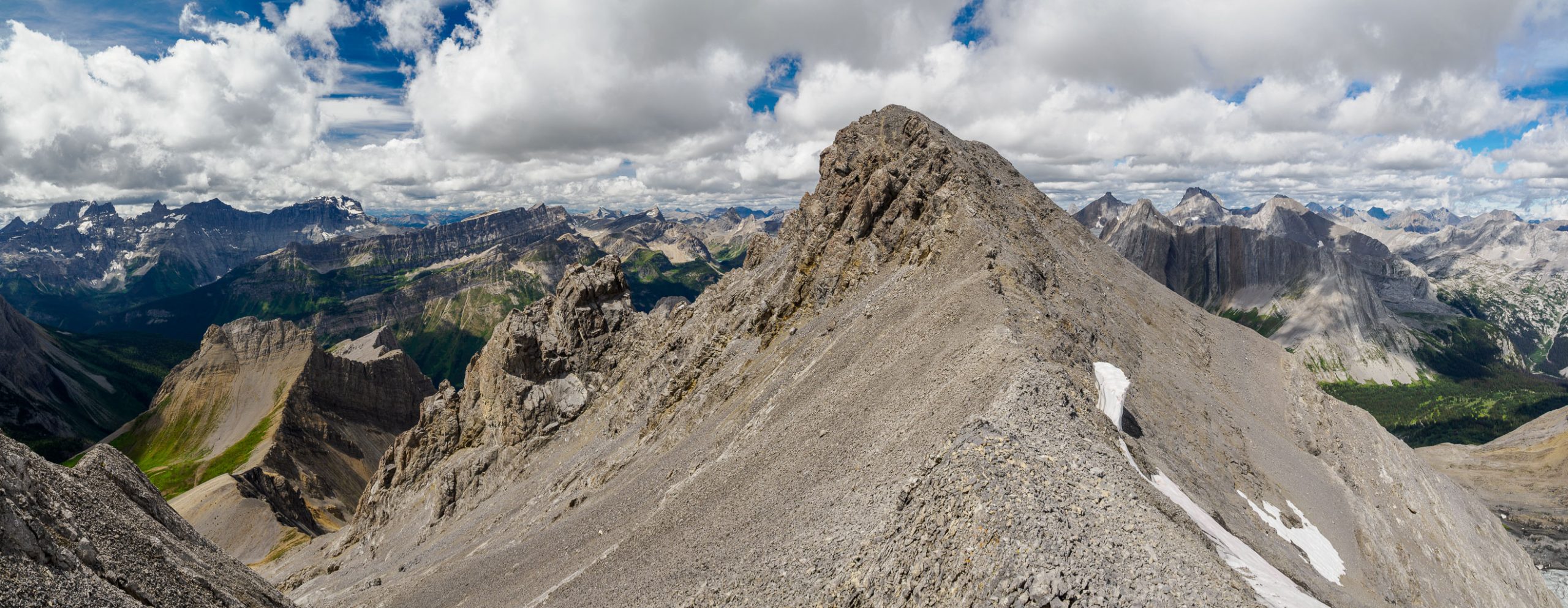
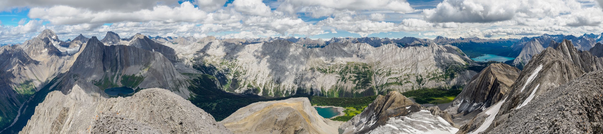
Some tricky bits of ridge later and I was striding to the main summit of the day with dramatic beauty in all directions. Tipperary Lake, the Royal Group and Sir Douglas stole the show, but many other familiar and unfamiliar peaks presented themselves as well.

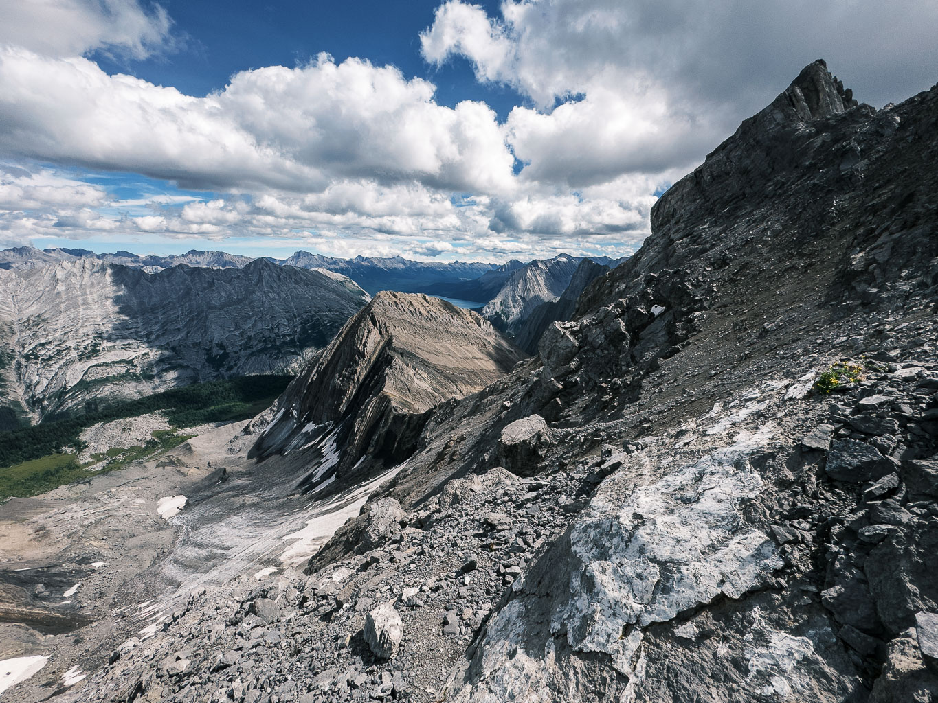
The hours were ticking by as they usually do on these sorts of trips so I didn’t linger long at the summit. Unfortunately the cairn was blasted by lightning (something I’m seeing a lot of on peaks with limited ascents) and there was no sign of a register. I carefully returned along the ridge and started down the tricky east face, trending south to the Razor Flakes col far below.


I was expecting a tricky descent and traverse to the col and I got it. At first everything seemed very straightforward and obvious but things quickly got tricky as they do. Every time I thought I was on a direct line to the col I would run up against an obstacle in the form of a cliff band or extremely hardpan, steep, unprotectable dirt. Arg. I always managed to find an escape but it still took well over an hour to travel the relatively short distance from the summit to an overlook above the col.


Instead of being home free at this point, I thought I was good and properly stuck now. The terrain directly under me was pretty much not possible to scramble. Now what? Once again, I poked around a bit and traversed down and around a cliff before finding a very steep crack leading to a rubble ledge below.

The crack was narrow enough to do a full body stem and you know how much I love a good stem. I made short work of the difficult step and a short grunt back up horribly loose rubble had me home free at the Razor Flakes col. Phew.


Of course, I wasn’t done yet. Despite Dave Jones’ promising a 2nd class route from the Beatty / Razor Flakes col there obviously isn’t a direct one. Even just getting to the col from the glacier would be 3rd class at the easiest due to glacier meltback and steep, loose slopes. From the col the “flakes” on Razor Flakes would make any direct ascent much harder than class 2 IMHO. I was getting a little tired of tricky terrain and slow movement so I decided to keep things as simple as possible and traverse the SW face of Razor Flakes to intersect the south ridge route that Devan Peterson recently posted as “easy”.


After one more tricky traverse along ledges from the col, following trusty goat paths, I made short work of an easy rubble sidehill to the south ridge. Here I made a sharp turn up hill to my left and quickly ascended easy terrain to the upper SE summit ridge.


The rock wall to my left was pretty stunning – this line of steep cliffs and sharp summits runs between Three Isle Peak and Mount Beatty. The broad summit of Razor Flakes offered now-familiar views.


Devan mentioned an easy descent via steep SE scree and grass slopes to the valley far below, so I decided to take this exit. It worked perfectly but was much steeper than I realized it would be! This might technically be 2nd class terrain, but it is bloody steep – far steeper than many SC5 scrambles I’ve done. If wet, the vegetation would be a real issue. As it is, I slipped on the alpine grasses a few times and once I almost didn’t stop! Do no underestimate this terrain, especially when tired as I was by now.


It was a huge relief when I finally exited to the small alpine valley below the SE face of Razor Flakes and traversed the short way back to the Maude / Lawson trail. I breathed a sigh of relief and started the long, easy march back to my bike.


The hours continued to tick by and 1.5 hours after descending Razor Flakes I was finally back at my bike. The uphill section just after the bike drop hurt a little but from there the ride was fast ‘n furious and I was very happy to be off my feet for a while. What a day! I hurt far more than usual the following day thanks to all the desperate pole clinging on the hard pack dirt slopes. My shoulders and legs were not used to that level of flex for so long. Most people would NOT enjoy Mount Beatty for many obvious reasons but Devan was correct when he confidently asserted that I would. For some reason I am attracted to these off-the-grid, rarely ascended, manky summits. I’m glad I never have to go back, but I’m also glad that I did it. Does any of that make sense? I doubt it, but then again does it have to? Thankfully not.
Impressive views and lovely write-up Vern! I wish that I had your speed and endurance!
Thx man. Given what you do in the mountains you have plenty of both. 😏 Congrats on the big “A”!
Thanks Vern! It was your ascent as write-up in 2012 that motivated me for this one. I only did the single summit, but it was the photos from the summit that really took hold of me – even though I really didn’t target the summit in earnest until a couple years ago, waiting for an ideal window… and it finally came!