Trip Dates: Tuesday August 16 to Thursday August 18 2022
Total Elevation Gain (m): 5800
Total Trip Distance (km): 106
Peaks Ascended: Afternoon Peak, Mount Frances, Lonely Peak, Mount McDonald, Oval Peak
Water Crossed: Nigel Creek, Cataract Creek, Afternoon Creek, McDonald Creek, Brazeau River
Quick ‘n Dirty Rating: Class 2/3 – you fall, you break something or worse.
Difficulty Notes: A remote trip with long distances of off-trail travel and routefinding. Ascents of steep, loose mountains with little evidence of humans in most places along the route.
Technical Rating: OT5, SC5, SC6; RE5
GPS Track: Gaia
Map: Google Maps
In 2015 I was invited by Eric Coulthard to do a trip into an area I’d never been before – or even heard of. He suggested we tag a couple of lofty summits in the White Goat Wilderness Area. I’d seen a few of the peaks in this area from nearby summits including Mount Stewart from Mount Coleman (the first trip I’d done with Eric way back in 2009) and Mount Willis which I’d spotted from Corona Ridge earlier in 2015. We had a fantastic trip and ever since I’ve been planning to go back. One of the main draws was the idea of hiking through the incredible landscape holding dozens of small lakes and tarns SE of Mount Willis. Another huge draw was the obscure and oddly named, “Afternoon Peak” which was a distinct reddish / purple color and was labelled incorrectly on almost every topo map available. As the years ticked by and I never got back into the White Goat I started to think it might not happen. In 2016 Liam Harrap, a friend from Jasper and a prolific obscure peak chaser managed to ascend Afternoon Peak with a friend. He’s the only person I know whose ascended that peak and it definitely got me interested again. He shared beta with me that implied a straightforward SC6 ascent via loose south gullies. Once again the years ticked by. Then in the brutally long and cold “Covid” winter of 2021/22 I dug into all my sources of mountain information to compile a large list of remaining summits that interested me. Afternoon Peak once again raised its head, but this time a whole bunch of additions came along for the ride. As usual. Peaks such as Mount Frances, Mount McDonald and Lonely Peak came onto my radar and I started planning a trip into the area to combine them all.
Wouldn’t you know it?! Ephraim Roberts – another prolific peakbagger of obscure and remote summits posted a trip on IG detailing his attempt at Mount McDonald and ascents of Oval (false Afternoon) and Mount Frances in mid-July 2022. I knew it was time for me to get into this area before it wasn’t such a mystery for me anymore. I contacted Eph and got his track which helped me realize that he’d gone into the area via a completely different route from the one I was planning. Already while planning the trip last winter I’d involved Sara McLean and perked her interest. Since we were both off the last full two weeks of August, I naturally invited her along and she naturally agreed to join. Plans were set, drivers were organized and all that was left was putting one foot in front of the other enough times to pull it all off. Sounds pretty easy no? It always does.

Day 1 – Approach and ascent of Afternoon Peak
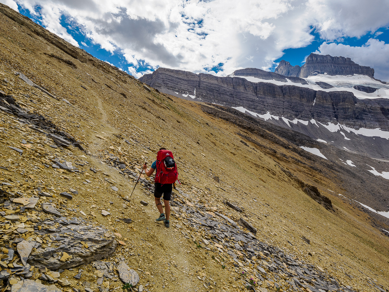
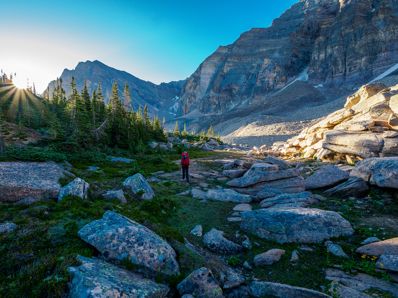
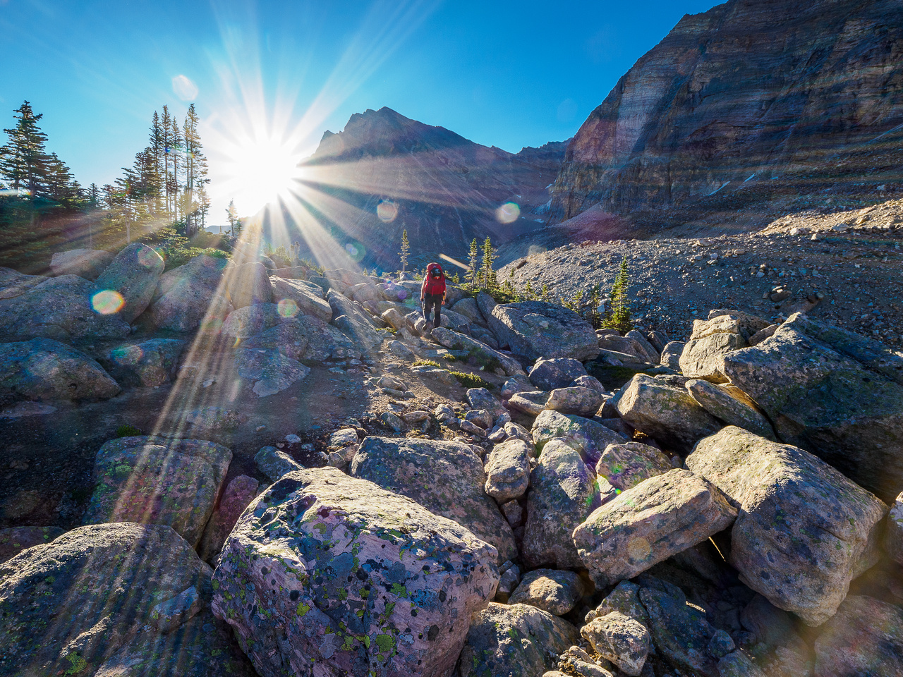
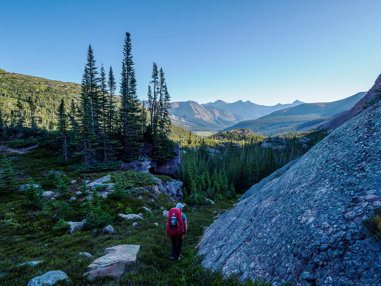
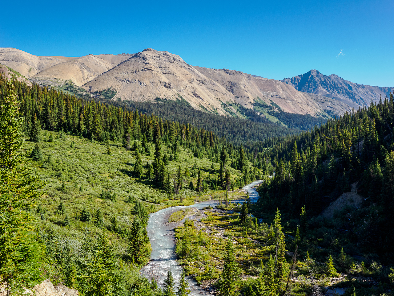
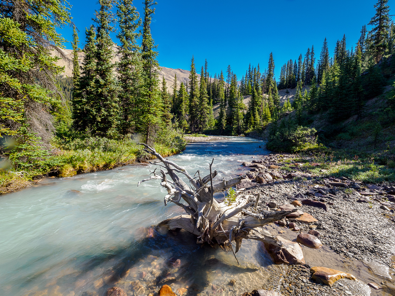
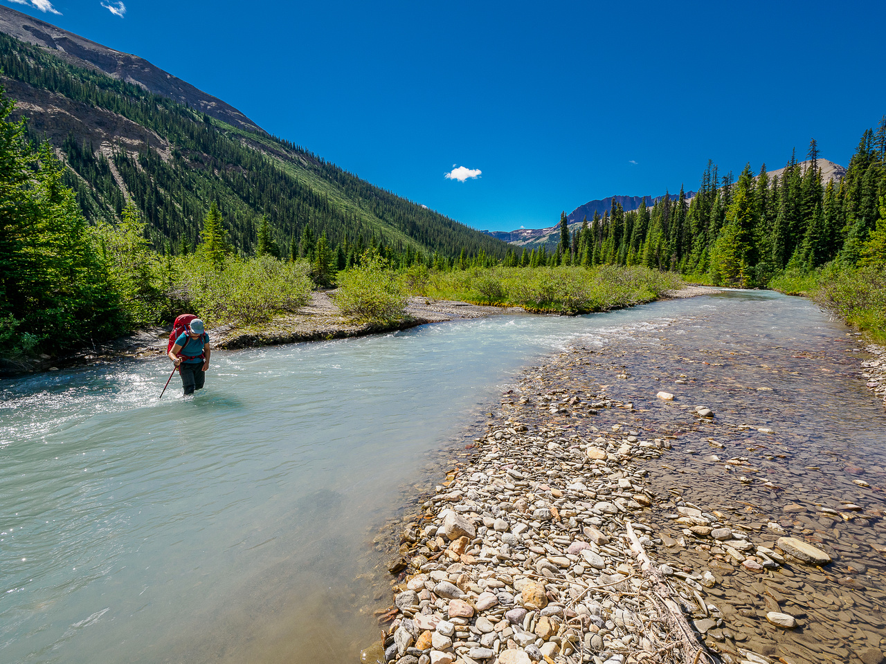
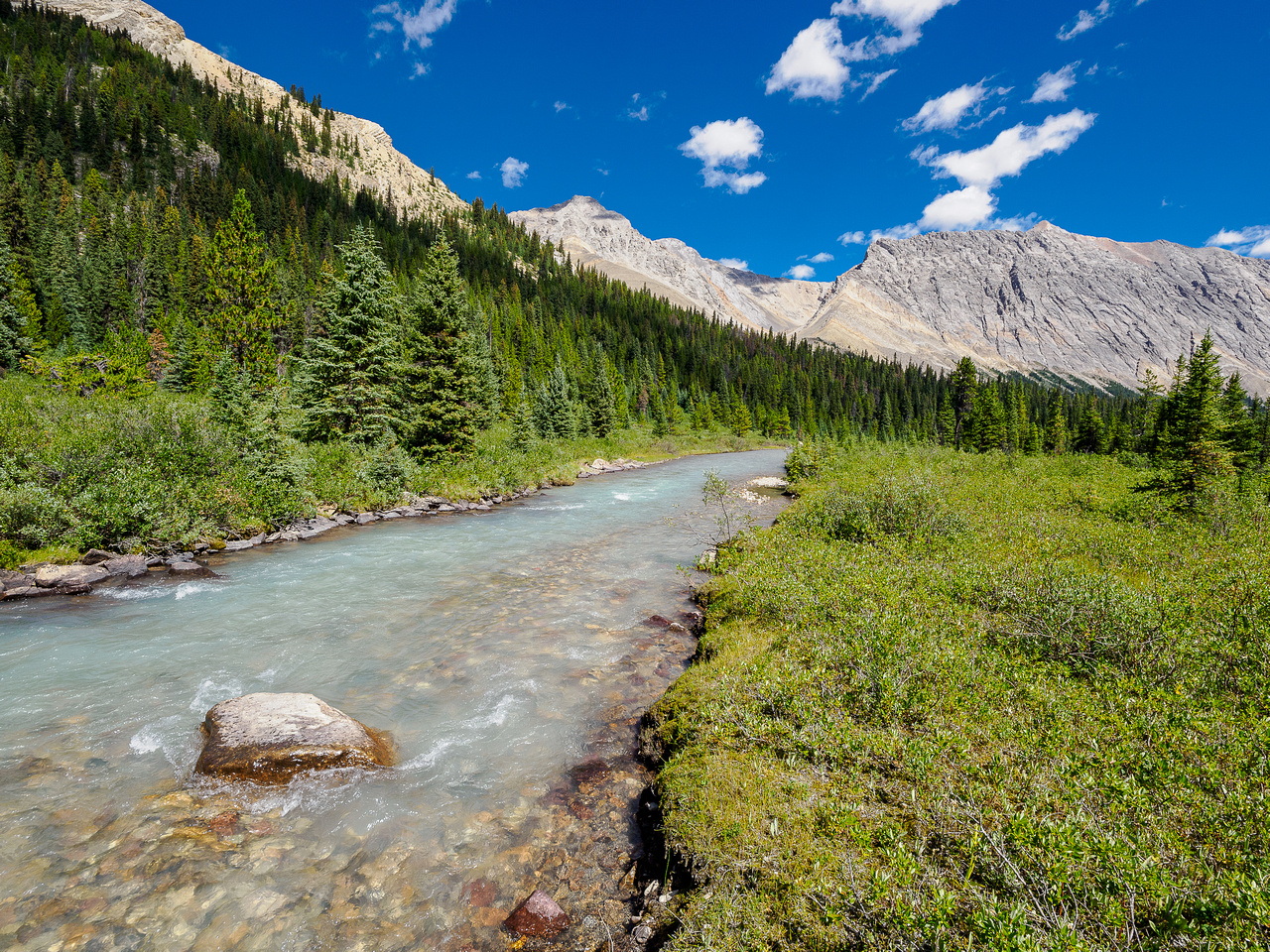
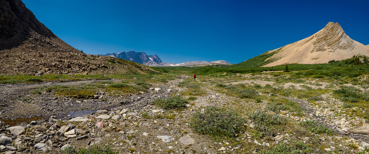
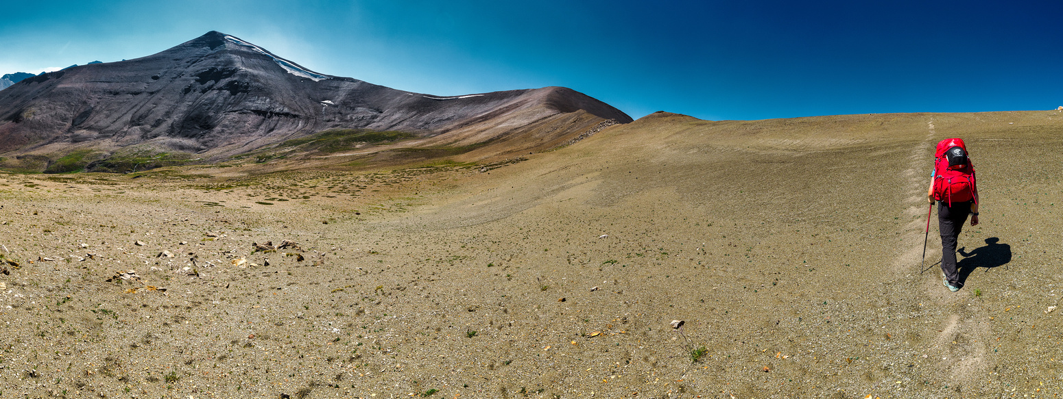
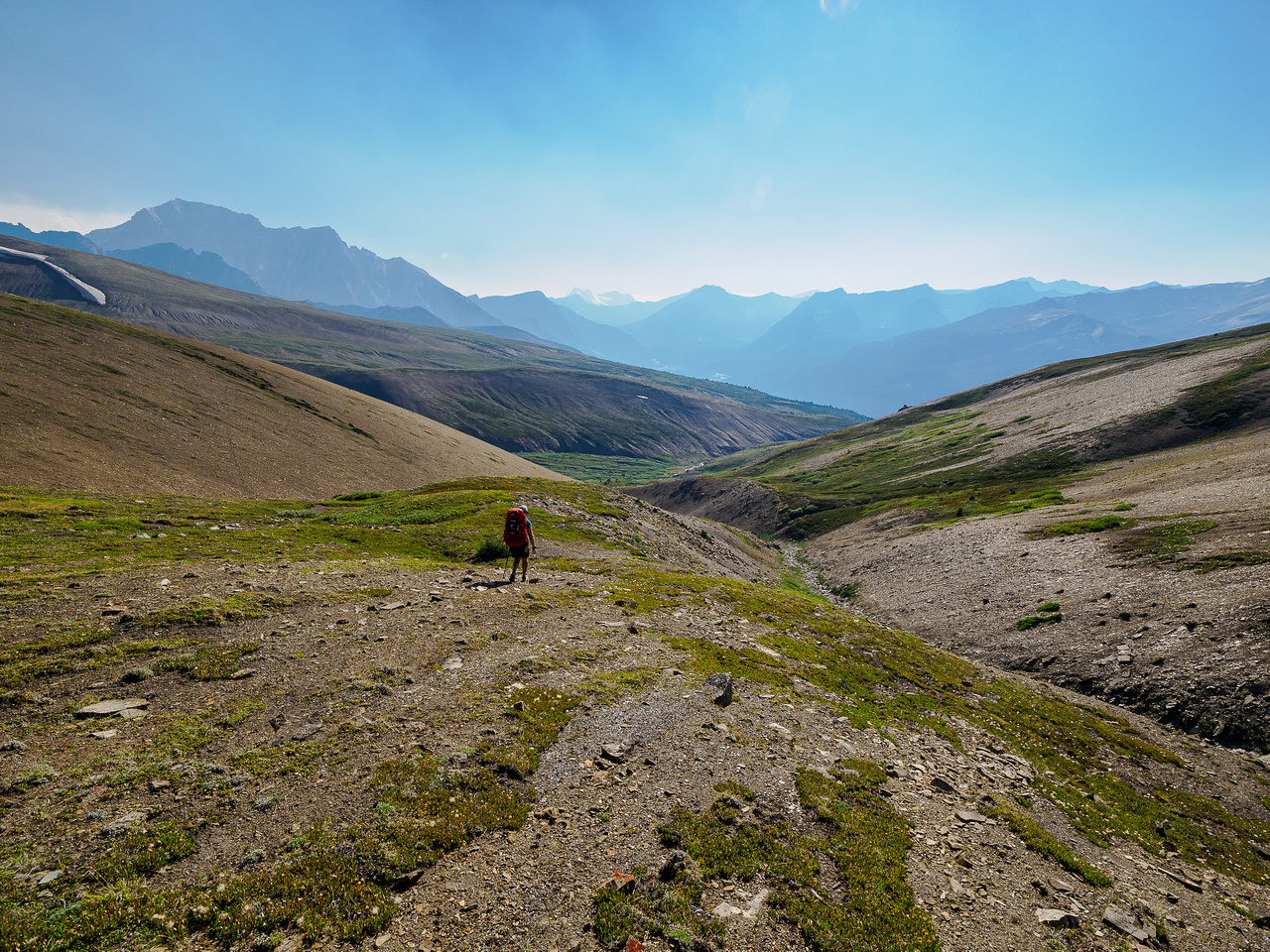
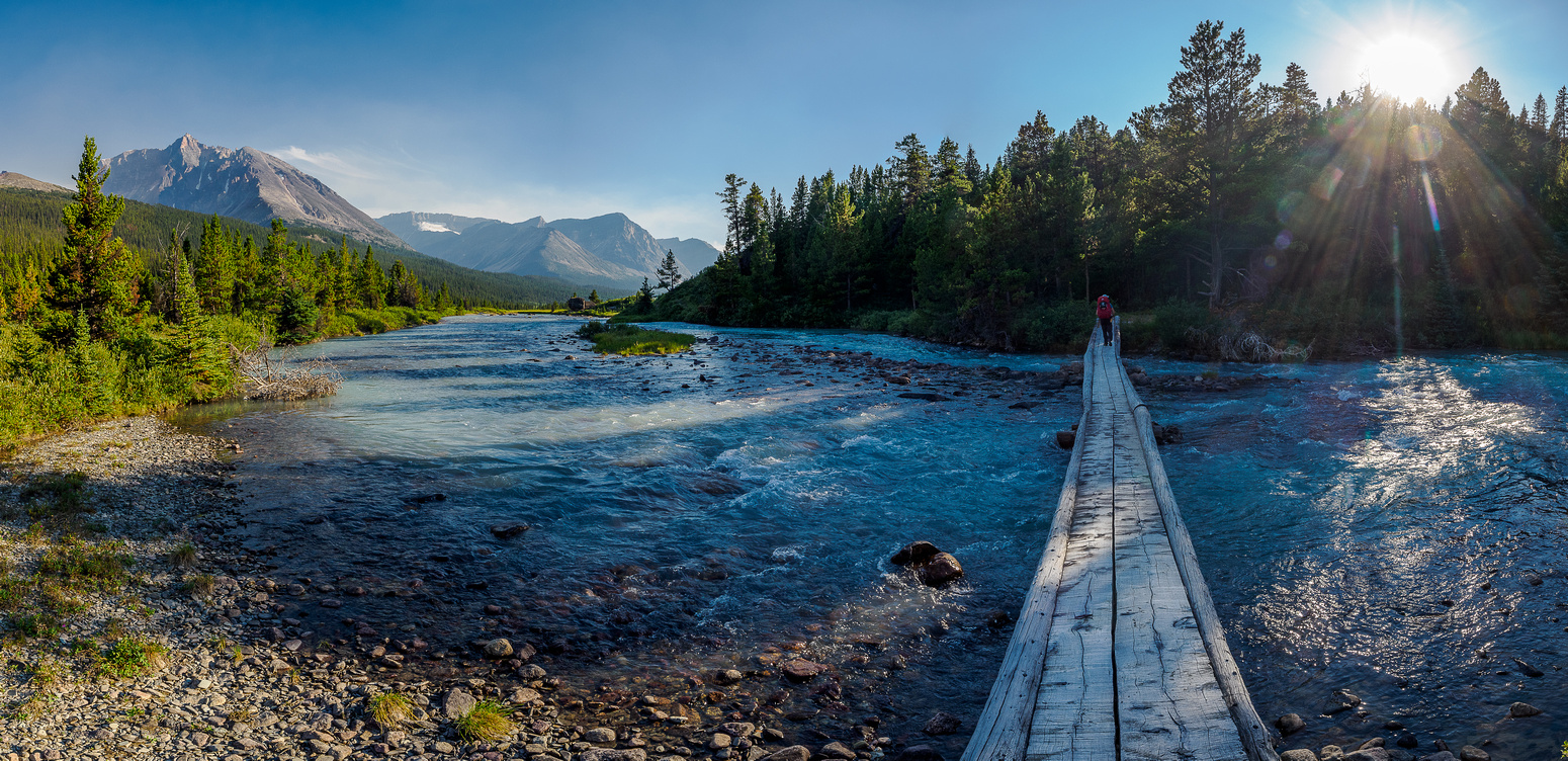
I drove to Canmore where Sara was staying and managed (with some difficulty) to park my Taco in her designated underground parking space designed for an undersized riding lawn mower. After a long drive up hwy 93 to the Nigel Pass trailhead we organized our gear one last time, shrugged into our large overnight packs and shuffled slowly off down the approach road along Nigel Creek. Within a few minutes of the car I realized I’d forgotten my bear spray but Sara promised she’d use hers if necessary so I didn’t bother returning for it. I knew I had bug spray and after a horrendous experience with them on Bonnet / Hickson a few weeks previous I figured that bug spray was way more important than bear spray. Sara had never hiked the South Boundary Trail or the White Goat Wilderness so she was in for a heckuva treat this particular summer day. The forecast for every other day was hot and clear but today was more of a mixed bag. It took less than 2 hours to hike the less-than-exciting 8 kms to Nigel Pass and from there the magic began – just as I remembered. Hiking alongside the upper Brazeau River to Cataract Pass was once gain a stunning experience. The landscape here is so unexpected and different from other areas of the Rockies. The river is a calm, murky, greenish blue color snaking through a shattered landscape with a winding route over rock gardens, flowering meadows and orange colored slabs.

By the time we were done hiking the 4.5km up the Brazeau River we were both totally into the trip. This was going to be one for the memory banks! As we ascended the trail to Cataract Pass and the border between Jasper National Park and the White Goat Wilderness, views over a couple of alpine lakes at the head of the Brazeau River opened up below. Cresting Cataract Pass, we briefly read the self-registration book and signs before continuing into the wild.
Mount Stewart and the dramatic, unnamed outliers of Cirrus Mountain loomed impressively over the Cataract Creek valley as we slowly descended the pass into the lovely headwaters of Cataract Creek. We crossed the shallow creek where Eric and I had set up our two night camp and continued towards Cline Pass. At this point we left any semblance of a trail for the next 1.5 days. We were now officially hiking through untrailed wilderness.
I could tell that Sara was already very impressed by the wild landscapes all around us. She mirrored me the first time I’d hiked through here – wondering at all the unnamed lofty summits and the unique feel of the area. I had a good idea what to expect from the ascent of Willis’ SE shoulder and we got it. Lots of rubble and huge shifting rocks. Arg. Sara danced up the terrain like it was no big deal but I get paranoid in this stuff. I remember stories of locals getting permanently injured by huge shifting boulders and I start thinking every single one of them will fall on me. As it turns out, this trip would dull my paranoia on this outcome simply by over exposure to it. Sara thought the terrain was quite solid.
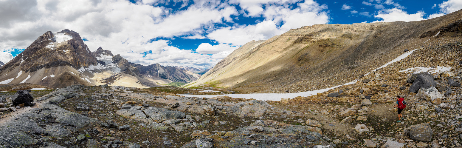
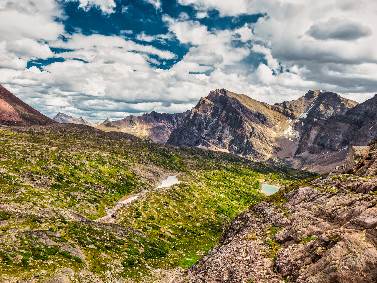
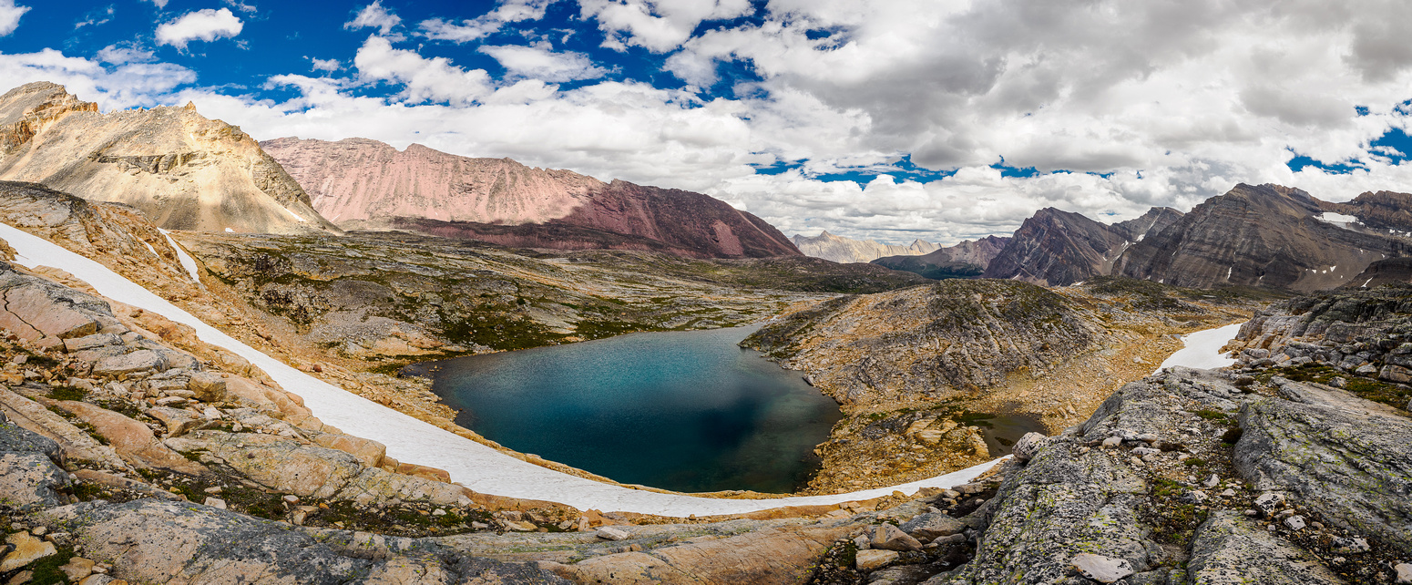
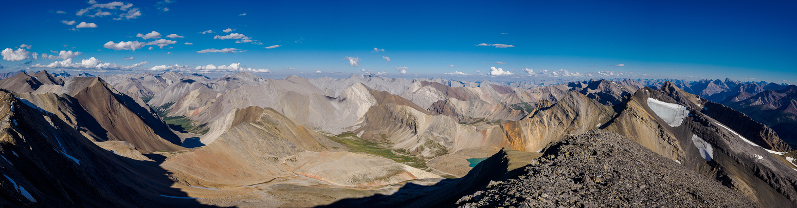
Within 5.5 hours of the trailhead and around 18.5 kms into our trip we got our first stunning views over the Afternoon Lakes valley. And we were both suitably impressed. It’s impossible to explain to folks who don’t share my passion for mountain landscapes but the combination of working so hard to get to them and the views combine into a feeling of contentment and purpose that few other things in life foster for me. Reading through my various socials I understand that it’s different for other folks who also travel these areas. Some of them are motivated by the physical challenges or the climbing challenges or the distance and time challenges. I am also motivated by those things but for me it’s the views of obscure and remote landscapes and the knowledge of the work it takes to get these views that really lights my engine and motivates me to chase after it.
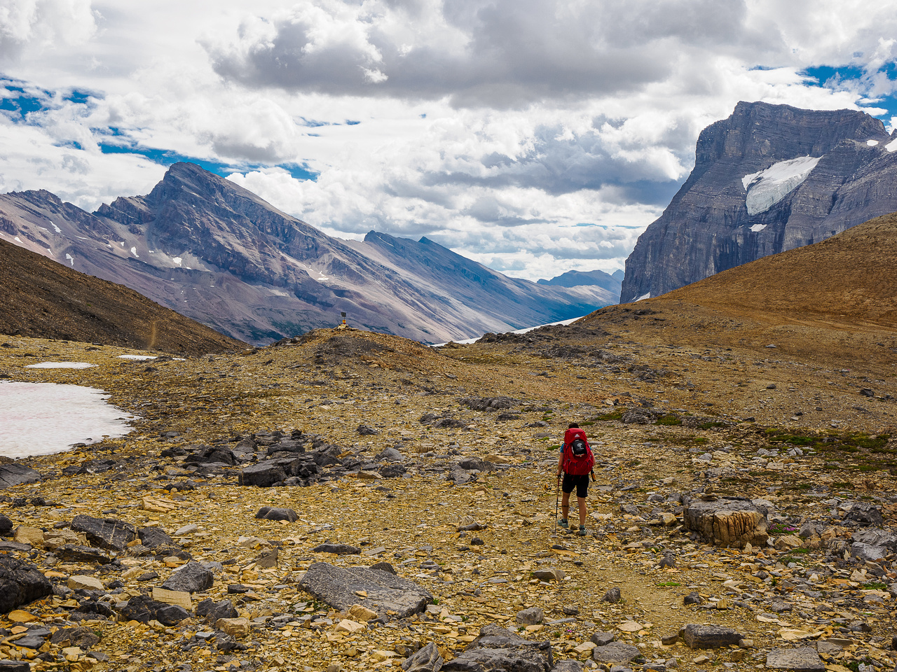
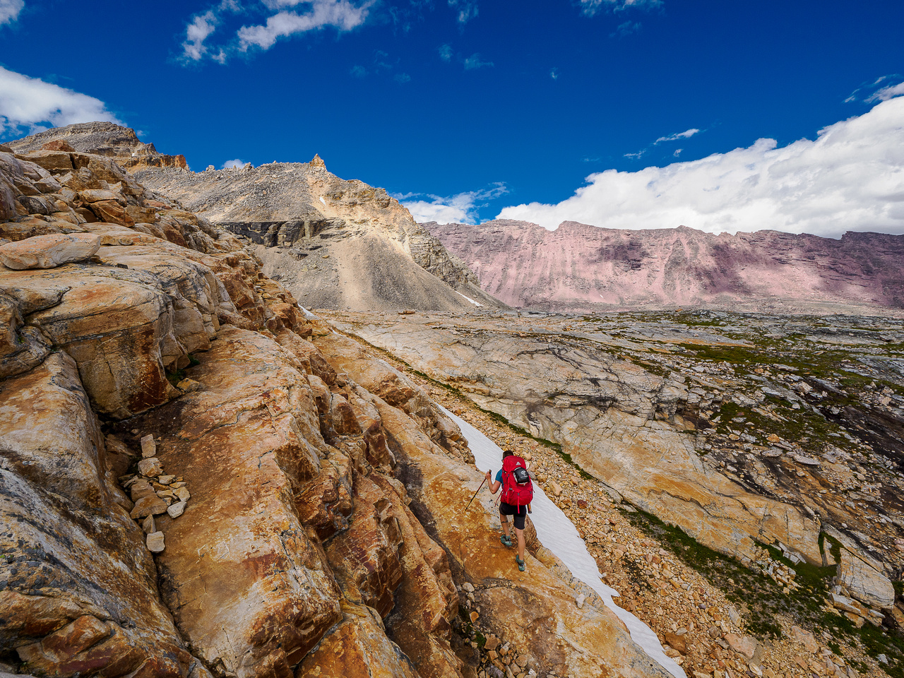
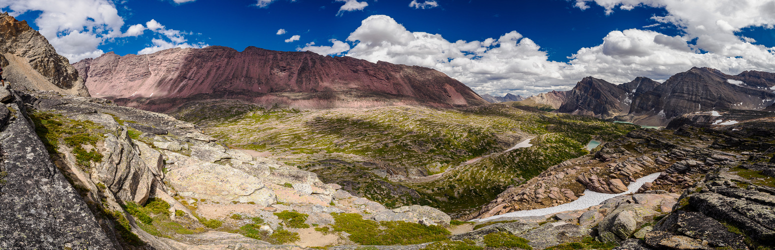
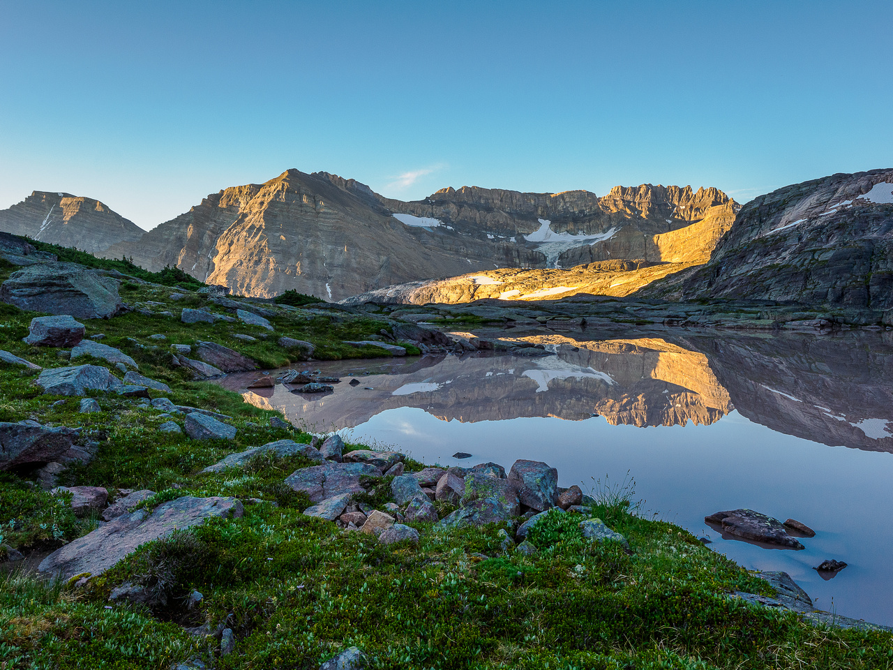
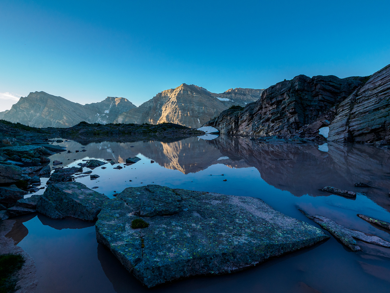
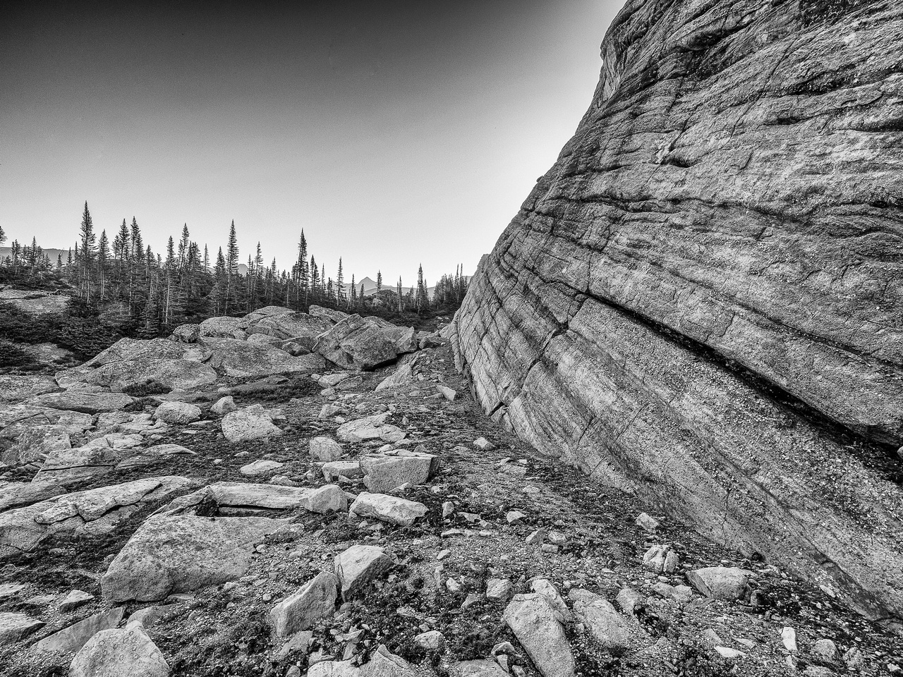
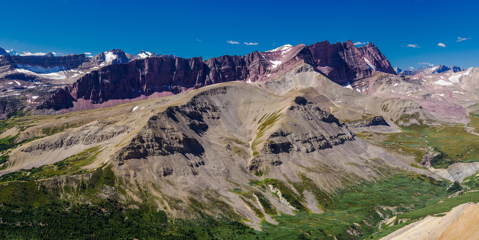
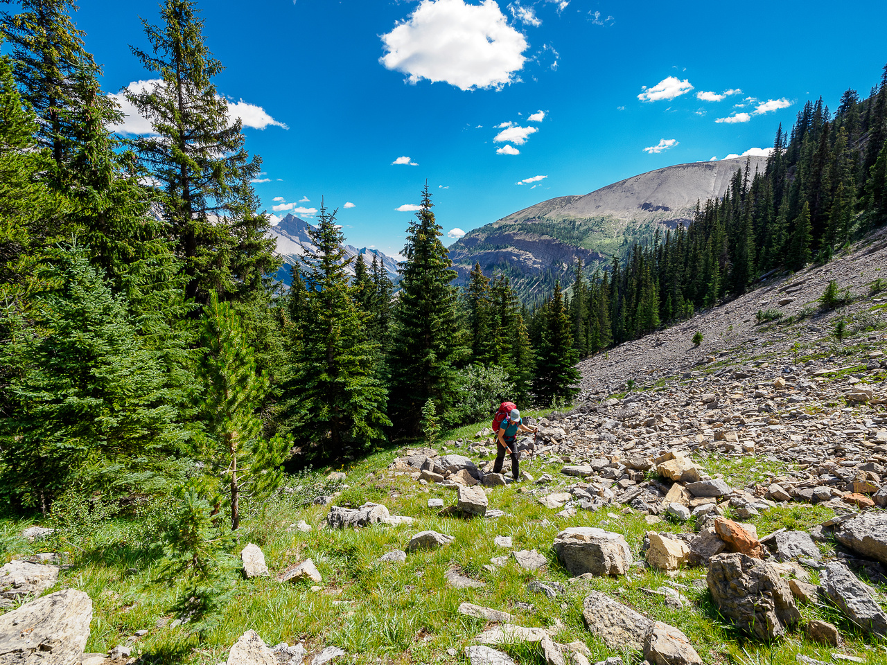
Afternoon Peak looked stunning in its red / purple hues as we began our descent onto the Afternoon Lakes plateau. I had spent quite some time planning a feasible route on Afternoon and still wasn’t convinced where the darn summit was! The fact that most maps label the incorrect summit didn’t help with the planning. Future Vern problem. Current Vern had to get onto the plateau and other than a low resolution dotted route line on a map somewhere, we had no idea what to expect. It was much easier than expected. Compared to other wilderness passes such as the ones used to access Deluc or Dip Slope or the infamous Quartzite Col, this one was much easier. Loose rubble and boulders led to – more loose rubble and boulders! I was sensing a theme for this trip.
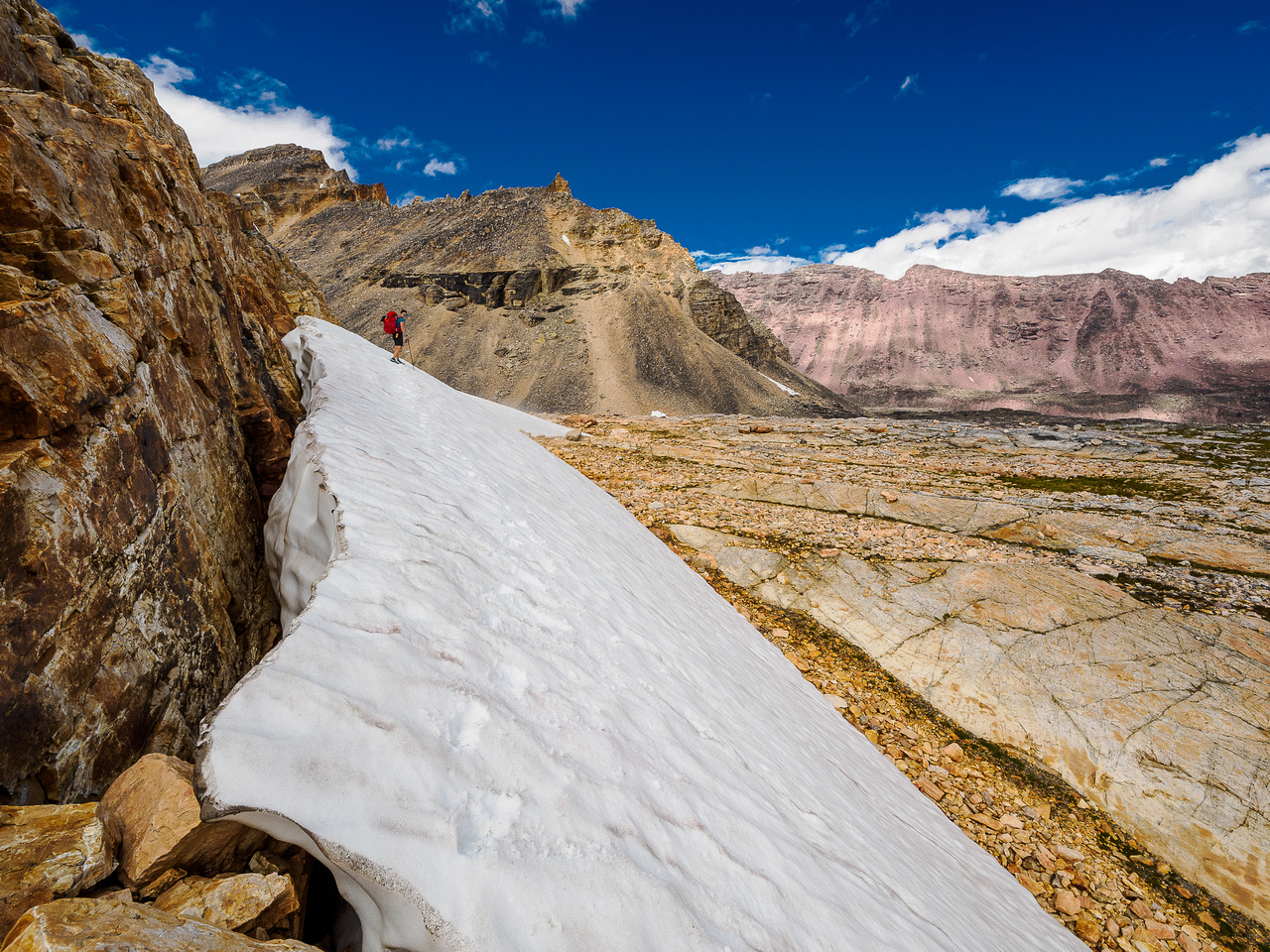
The next 1.5 hours or so were pure wilderness hiking paradise. Originally my line over the Afternoon Lakes plateau to Afternoon Peak went down the plateau to the east and then all the way back up a valley under Afternoon’s long SE shoulder. Sara recalled a much more efficient line she’d spotted heading directly NE along the plateau, sneaking towards Afternoon Peak around the SE end of an unnamed peak between Willis and Afternoon. She wasn’t 100% sure of course, satellite images aren’t that accurate, but it was certainly worth a shot. Worst case we’d be an hour or so out of our way but best case we’d save hours of hiking and many meters of height losses and gains.
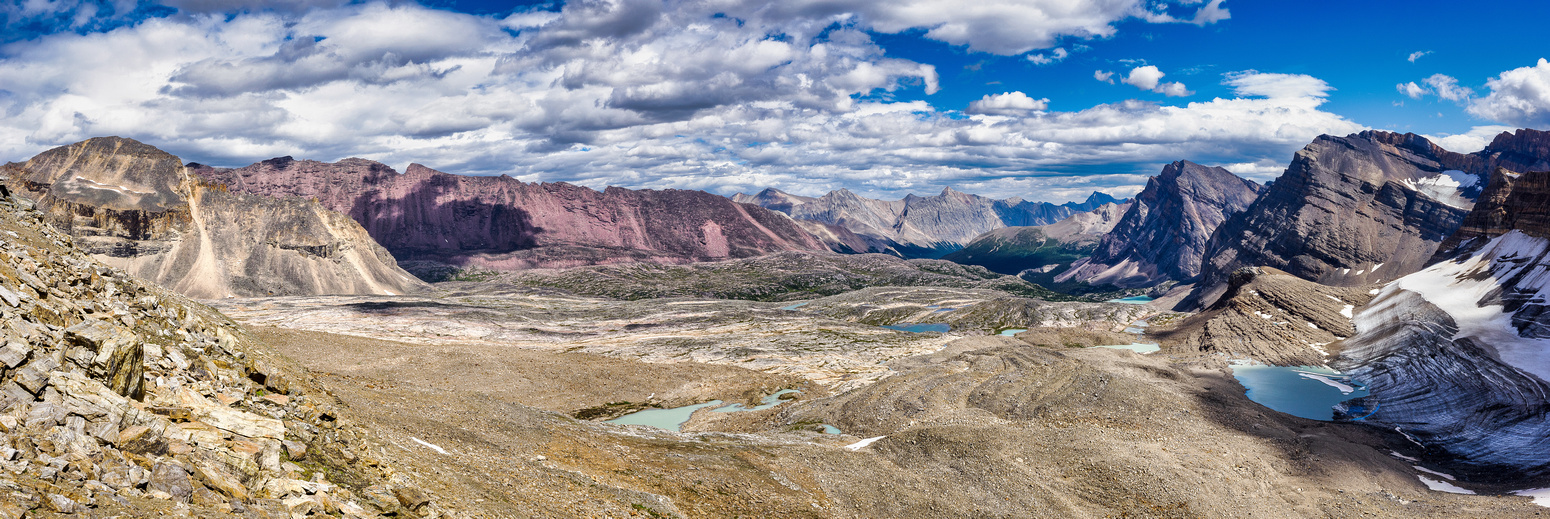
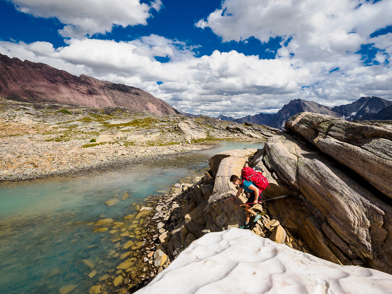
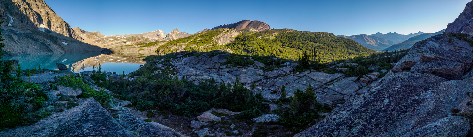
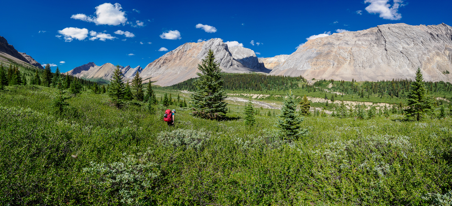
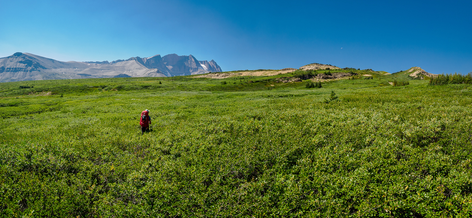
The landscape was just as scenic along the plateau as I’d expected. It was also more work to walk through than I thought it’d be. Firstly we noted that there’s no way that the valley is made up of “Karst Pavement” as I originally thought when I saw it from Mount Willis. Karst Pavement is limestone and this was clearly Quartzite. This didn’t really affect the navigation but the fact that there were so many tarns and lakes to work our way around did. Limestone would have drained many of these water bodies whereas quartzite did not. Although the ponds were gorgeous they were also a barrier to direct hiking and every one of them involved rock and boulder hopping to circumvent. Not to mention height losses and gains to get out of the dips they were in! It was worth all the work for the views but it did add hours to our effort.
We had a blast hiking here. The quartz slabs were a pile of fun to hike up and over, using little ledges and bits of meadow to get over them. The landscape was so unique to the Rockies that we forgot about all the inconveniences and focused on how lovely and fun this was. As we approached the SE end of the unnamed peak we really hoped there was a way into the valley under our peak.
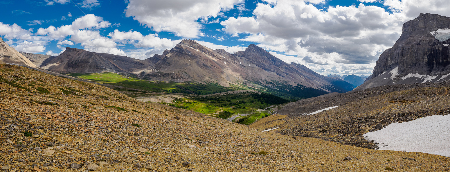
As we crested a last high point with direct views of the valley below we breathed a huge sigh of relief. The route would definitely go. YES. Thank you Sara for that great suggestion. This is why trip partners are so important. They need to be able to not only spot things you might miss but also be confident enough to suggest them. The views over the valley south of Afternoon Peak were even more stunning than the ones we’d already been enjoying. They were out of this world. Sara said the strange green, rocky landscape reminded her of mountains in eastern Europe. They sort of reminded me of the approach to Mount King Edward but these were much more expansive.
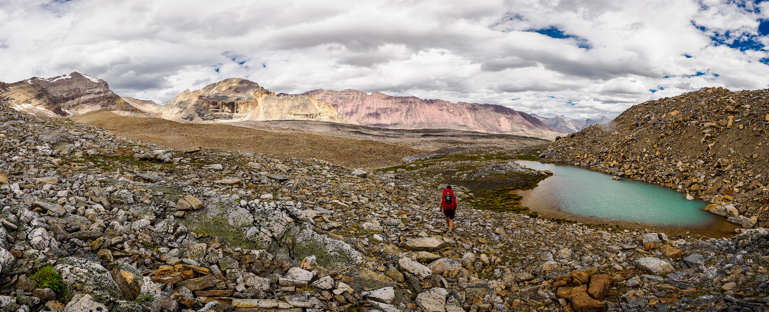
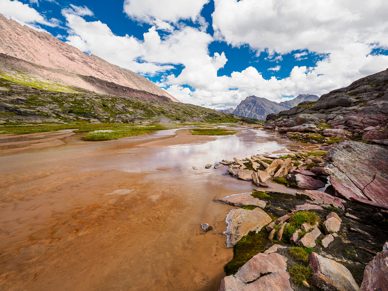
Even though we were 99.9% sure the route ahead would go, you never really know for sure until you make the trip. So we did. And it worked as expected. We descended ledges, slabs and rubble until finally we bottomed out at a red stream draining Afternoon Peak and more incredible views.
It took us roughly 7.5 hours to cover the 22.5 kilometers of approach towards Afternoon Peak. We decided to drop the overnight packs and tag the peak before deciding what to do overnight. After a very loose and tiring 3 hour round trip of Afternoon Peak we lacked energy to do anymore backpacking.
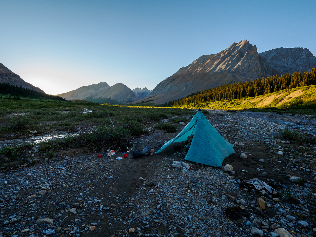
We wandered slightly downstream to find a flat area and set up camp under the SE ridge of Afternoon on soft alpine meadows near the red colored outflow stream. What a day! It was already feeling like one of those epic trips that lives on for years to come. The views were overwhelming. Some days are like that but rarely do whole trips come together like this one seemed to be. In another display of just how perfectly this trip was coming together, we got some sprinkles of rain just as we entered our tents – perfect timing. Despite a lingering Covid cough I slept like a baby in warm and windless conditions at our high camp. I was very content to have finally ascended Afternoon Peak and hiked the gorgeous Afternoon Lakes plateau.
Day 2 – Francis Peak and Lonely Peak
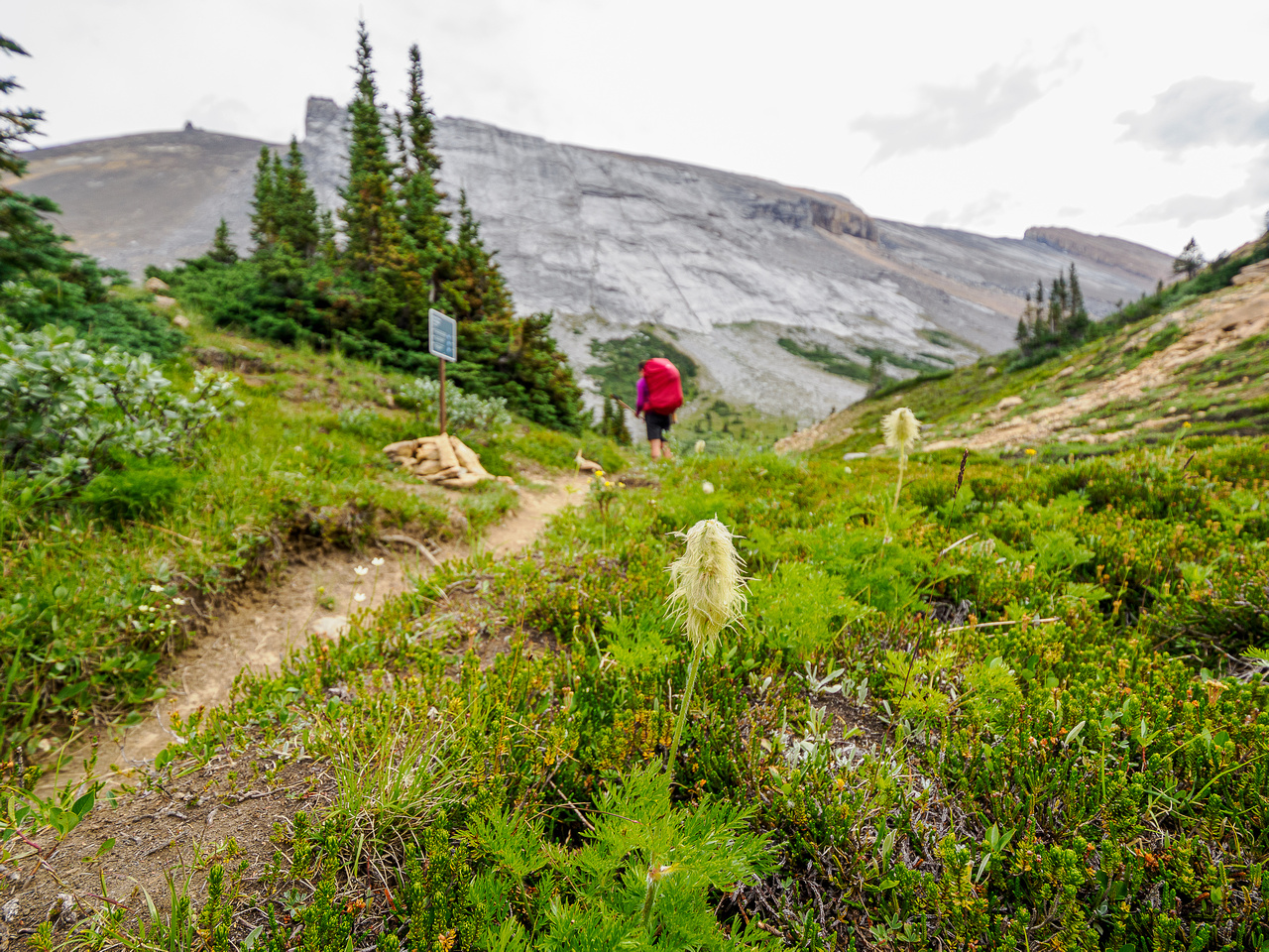
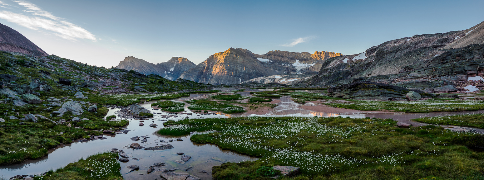
After a good night’s sleep at our high camp under Afternoon Peak, Sara and I woke at around 06:00 on Wednesday August 17 ready for another day in paradise in the White Goat Wilderness Area. Our plans for day 2 of a 4-day excursion into the very heart of the White Goat was to exit the Afternoon Lakes plateau and valley along its main drainage towards McDonald Creek. Along the way out we’d tag Mount Frances via easy looking south slopes before contouring its SE shoulder into the McDonald Creek valley. A stretch goal was to either ascend part way to Mount McDonald before bivying or possibly ascending Lonely Peak. Plans got fuzzy at that point because the timing got off. More on that later.
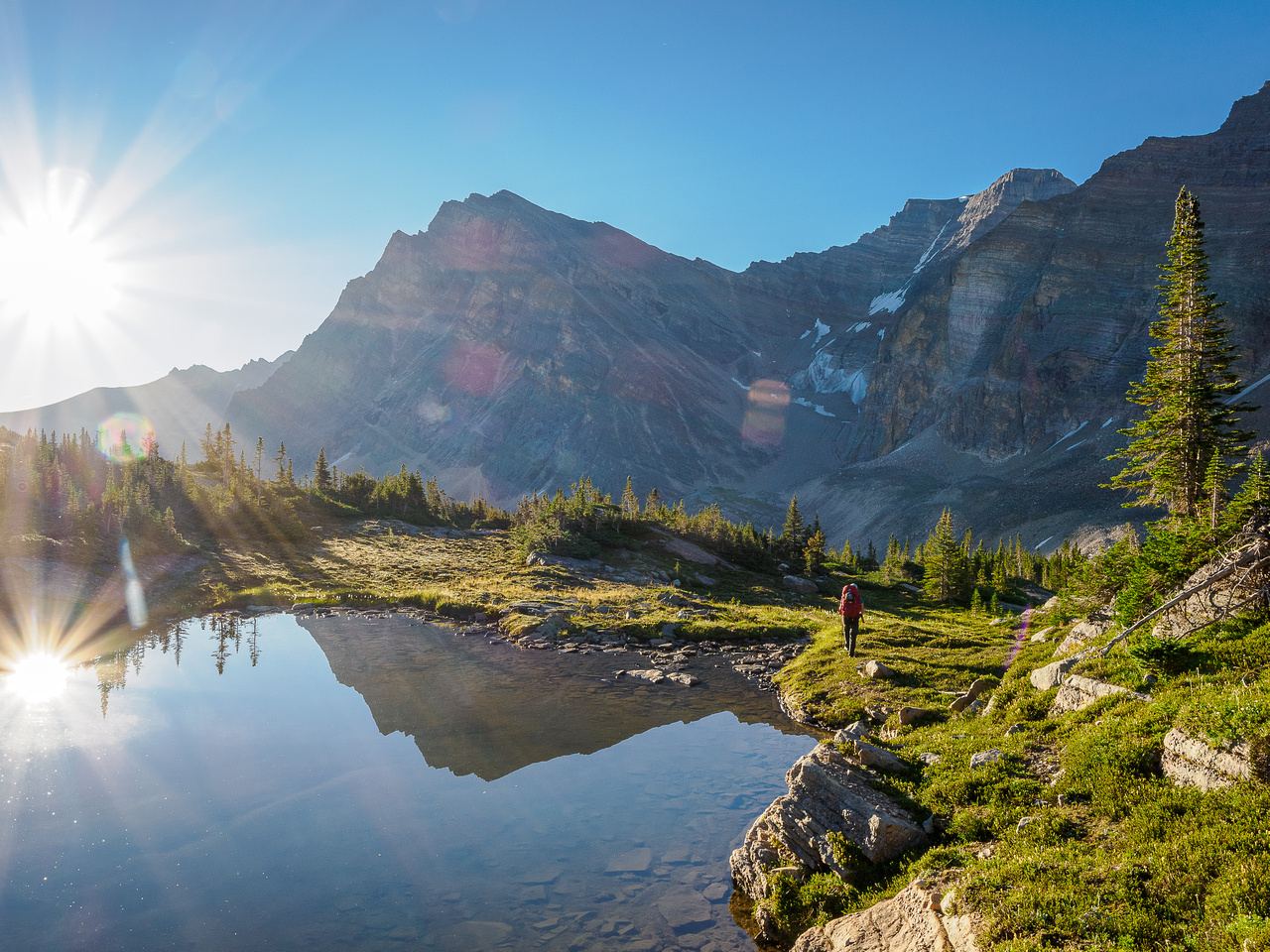
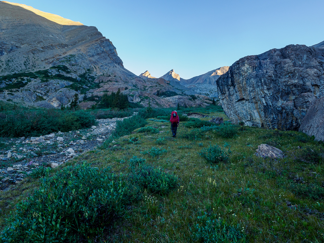
After a quick breakfast and packing up our camp under Afternoon Peak, we bid the horribly scenic and horribly loose mountain “adieu” and started our exit of the Afternoon Lakes plateau. The next few hours were hiking bliss. I realize that I keep using exaggerated language in this report but the experience justifies it. Trust me. We were constantly picking our jaws off the deck as we took in view after view after view.
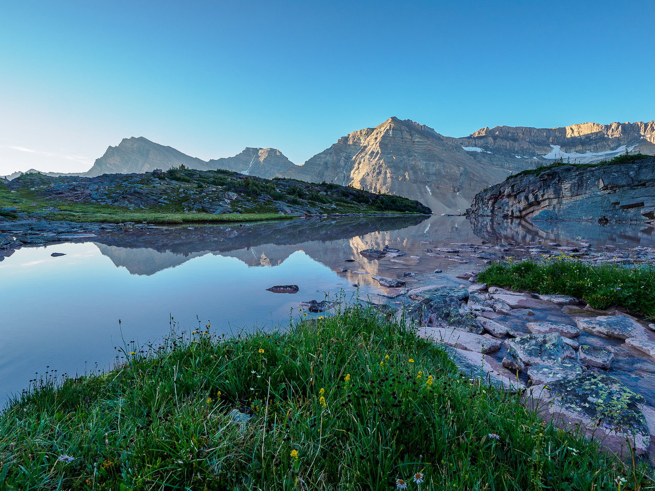
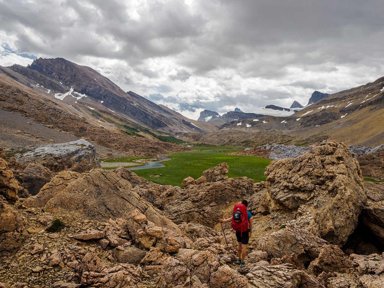
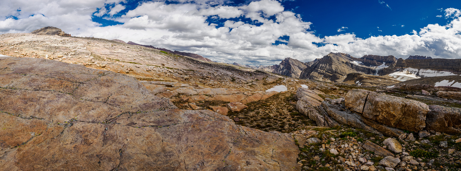
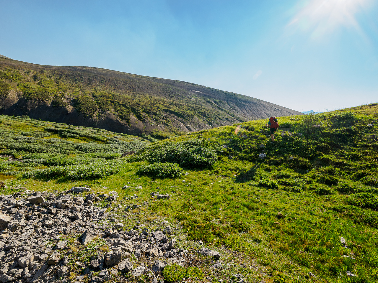
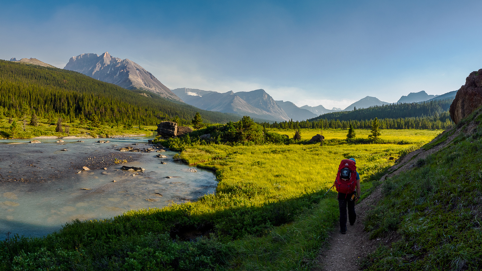
Flowers, tarns, ponds, cliffs, glaciers, grasses, shadows and light, mountains and sneaky little routes through small valleys and gaps in the tiered landscape all combined to keep my camera very warm. As we slowly descended the plateau into the main valley we noticed a similar theme to the day before when we first entered the area. Although very scenic, this type of landscape can be a lot of work to navigate blindly! Every lake meant walking around it on loose or undulating terrain. Every patch of forest was thick and difficult to push directly through. There were no animal trails (and no animals we could see) here either – very strange for such a protected landscape.
After a short but fierce bushwhack we encountered our first proper lake – large enough to warrant a few extra moments of planning how to deal with it. We decided to hike around it’s rocky shore rather than the bushy one – a great choice when you have it! Naturally the rocks were looser, bigger and more convoluted than originally thought but that’s the nature of off-trail hiking. And make no mistake – this was wilderness travel at its very best.
The landscape was gorgeous in early morning light as we navigated our way up and over small and large cliff bands on tiered meadows and loose ledges. We were moving slowly but we kept moving. I’ve never hiked in such extensive off trail terrain before with an overnight pack. Sure! I’ve bushwhacked and streamwhacked and been way off trail in the Rockies many times but this felt different. We were really out there on this one – there wasn’t the hint of a trail or a track through the convoluted terrain.
I’m sure we didn’t necessarily take the very best line off the plateau into the lower treed valley but we managed to get there within an hour and a half and found ourselves following the main stream draining the plateau above. Here again, we encountered some incredible views as we topped out on another sparkling green lake along the stream. This time we faced bushwhacking no matter which way we went so we picked left.
The morning sun was already hot as we bushwhacked and rubble-hopped our way around the last big lake we’d encounter this day. Over the past 1.5 hours Mount Frances had slowly been growing larger and larger as we approached it and descended down the valley. We were growing a little bit concerned about the amount of willows visible in the valley below and obviously the forests were also growing more dense the lower we hiked down valley. What would we find? Would the terrain become nearly impassible? There was nothing to do but keep hiking with fingers crossed.
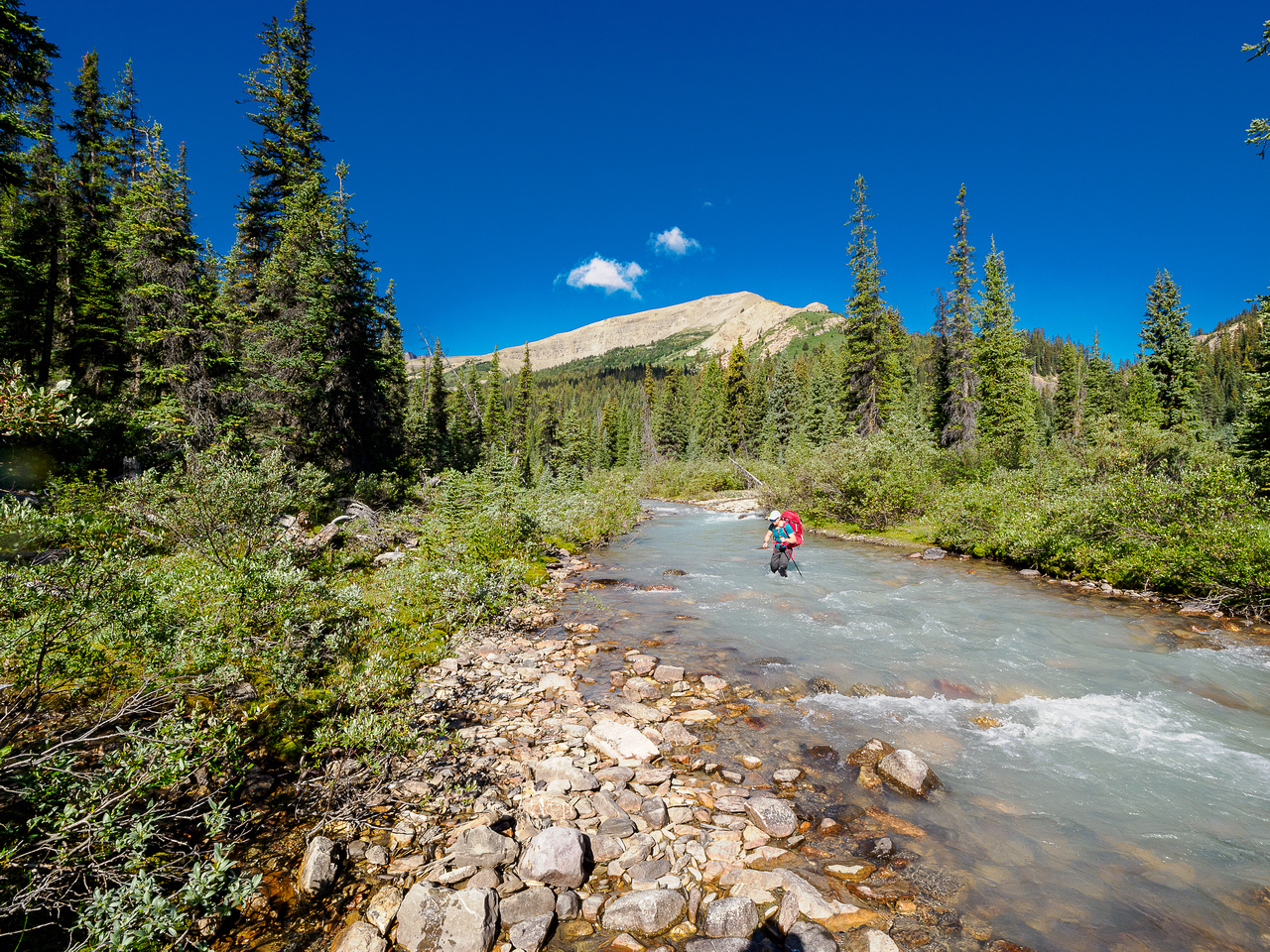
We started out carefully avoiding the creek and taking advantage of smaller willow fields before giving up and hiking right down the creek. There really wasn’t a choice but to get wet feet again and we crossed the creek dozens of times on our way towards Francis Peak. Once again the strategy of hiking with wet shoes saved many hours of time as we marched relentless down the clearest edges of the creek. We paid the price for having wet feet with heavy packs but not until later in the trip. By around 11:00 we were south of the slopes I’d marked for ascent on Mount Frances and started towards it with our light day packs.
After an easy but HOT ascent of Mount Frances, Sara and I were faced with more hard work ahead. Our next objective was getting out of the “Afternoon Creek” valley and into the McDonald Creek one. We knew we could get around the lower SE ridge of Mount Frances but we didn’t know what kind of terrain we’d encounter doing so. After continuing down the creek for a couple kilometers we finally left the drainage and started up and around forested slopes into the McDonald Creek valley. After a short and light bushwhack our day improved dramatically with flagging and a hint of a hiking trail leading up forested slopes high above McDonald Creek. The trail was a very fortuitous find as the McDonald Creek drainage looked very bushy below our current vantage.
The trail was most welcome and was an excellent mental break. It didn’t last long but soon we broke out of the forest to a rock meadow below the NE face of Frances which we easily followed to willows and meadows in the McDonald Creek valley between Mount Frances and Lonely Peak. From here we spotted our planned bivy near the creek and headed across the valley.
We spent the next hour or so setting up camp, hydrating and getting ourselves ready for the next objective of our day – Lonely Peak. Originally when planning the trip I’d planned an in-and-out route via the Afternoon plateau but now we were changing our minds on this idea. With my original plans I knew that ascending more than 3 peaks was pushing things and I thought we might get Lonely Peak on our way back out after tagging Mount McDonald but I highly doubted it. When standing on Mount Frances Sara wondered if we should follow Ephraim’s route over the north shoulder of Oval Peak down to the South Boundary Trail instead. Considering how much work the Afternoon Creek and plateau had been to descend, we both agreed to change our route to something that was hopefully going to be more efficient and less work. I love the fact that we could make such a big change to our trip part way through it. Not everyone would be up for this type of change.
As we started towards Lonely Peak we again had no idea what to expect, only having a trip report from Rick Collier in 2011 to go on. Rick’s report isn’t clear but it seems like he ascended it from the north. We had another route planned, using his easier descent route.
I’m not gonna lie. I was feeling pretty darn tired by the time I clambered up to my tent on McDonald Creek on the evening of Wednesday, August 17! We’d had a pretty big day exiting the Afternoon Creek valley, ascending Mount Frances and Lonely Peak and routefinding our way through many kilometers of untracked and untrailed mountain landscapes. Mentally I wondered how far we could push things the following day. We’d been discussing a strange predicament already since deciding to exit via Ephraim’s route through the Afternoon meadows and over Oval Peak’s north shoulder and down to the Brazeau River and the South Boundary Trail. Where the heck would we camp on Thursday night? It seemed like we’d end up in Jasper National Park with no camping permits and no legal way to random camp. Future Vern problem – I fell into a restless sleep in my tent.
Day 3 – Mount McDonald and Oval Peak
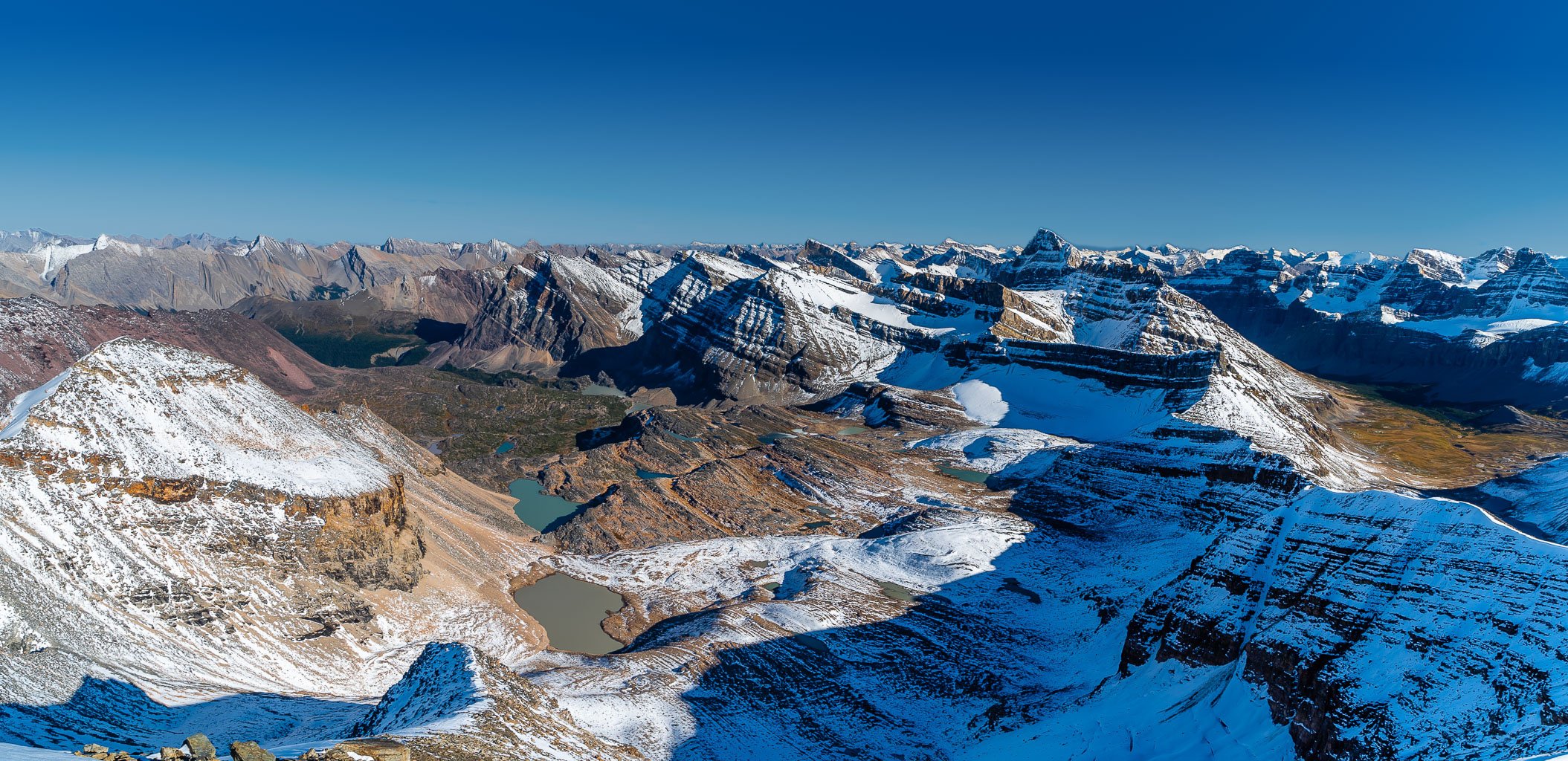
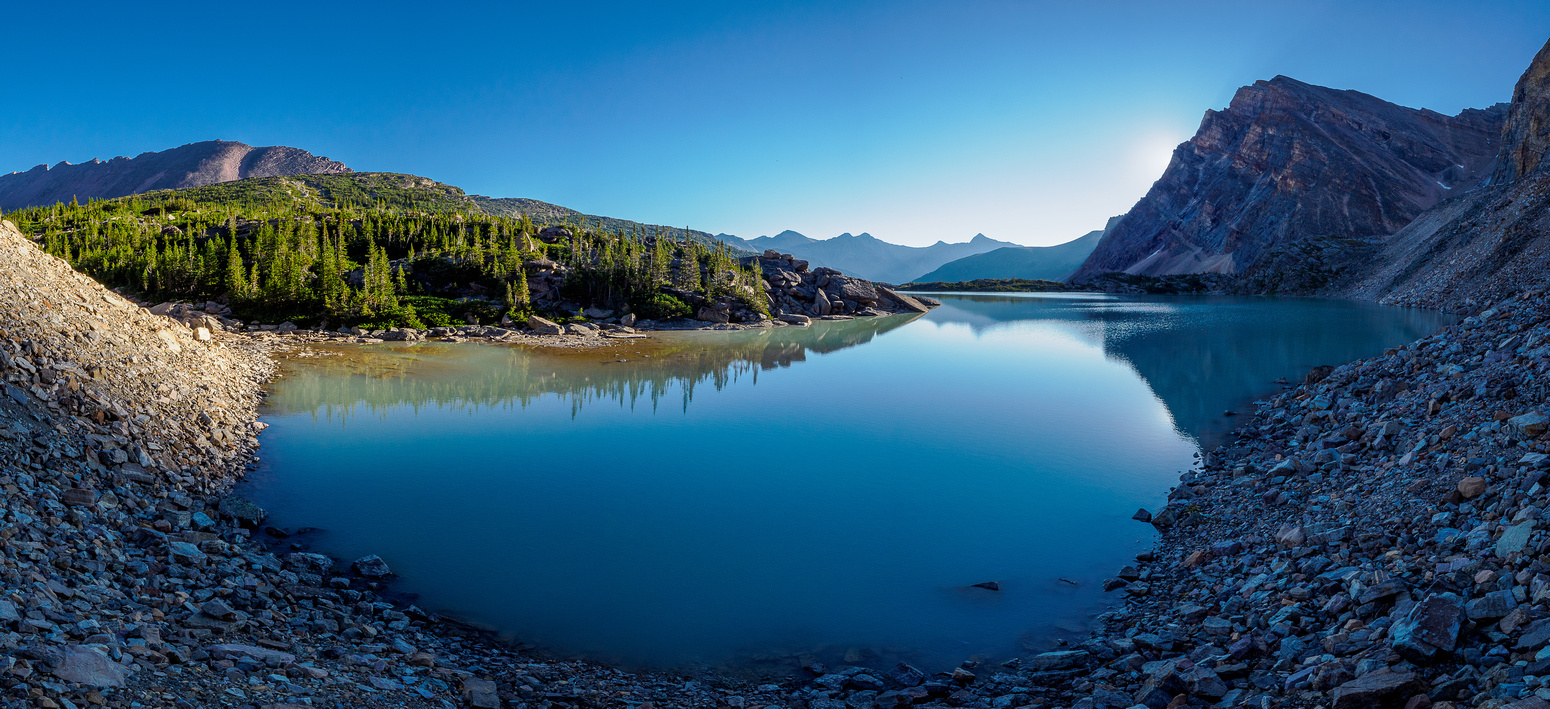
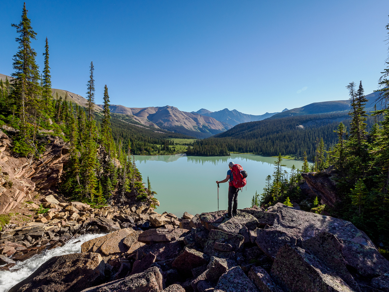
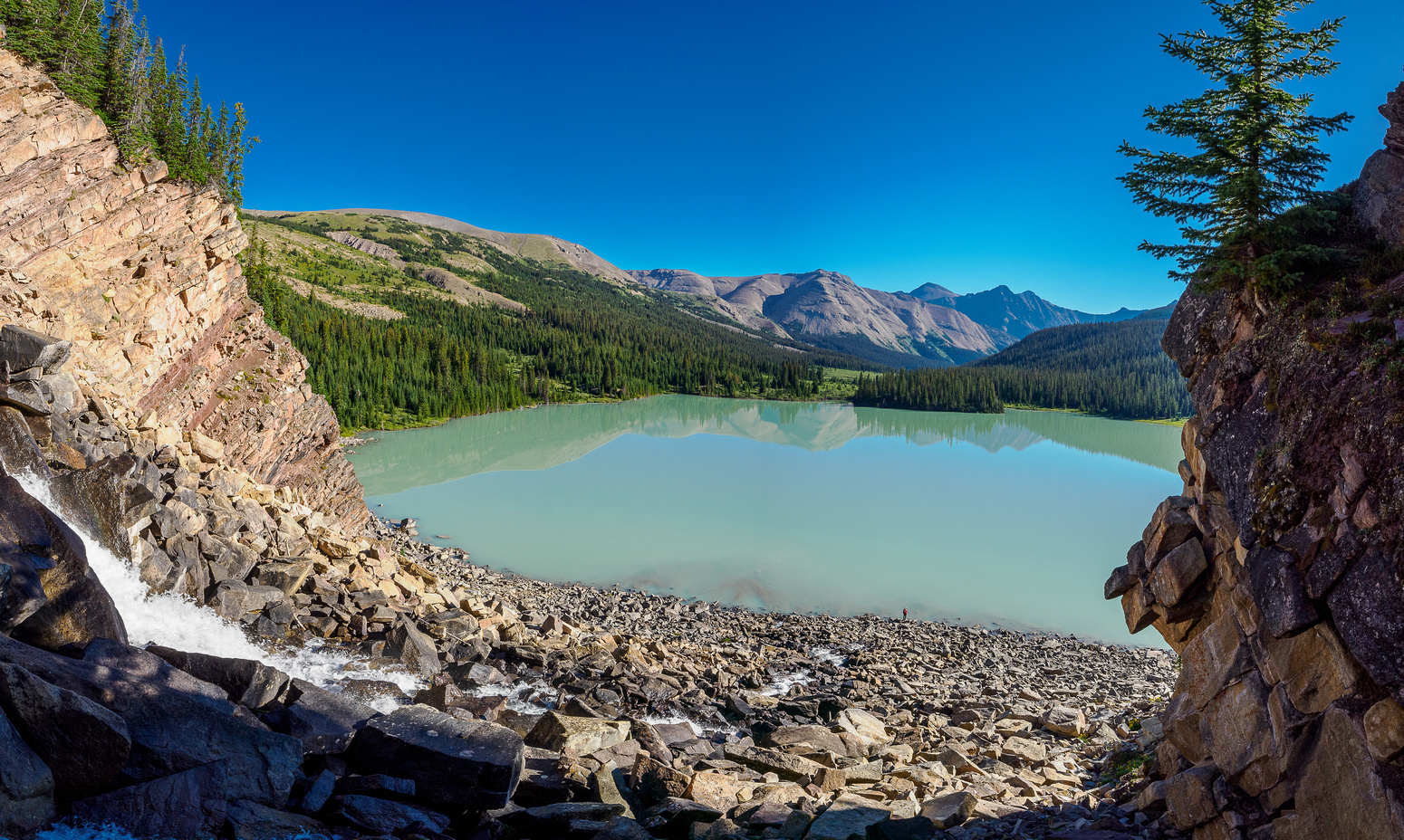
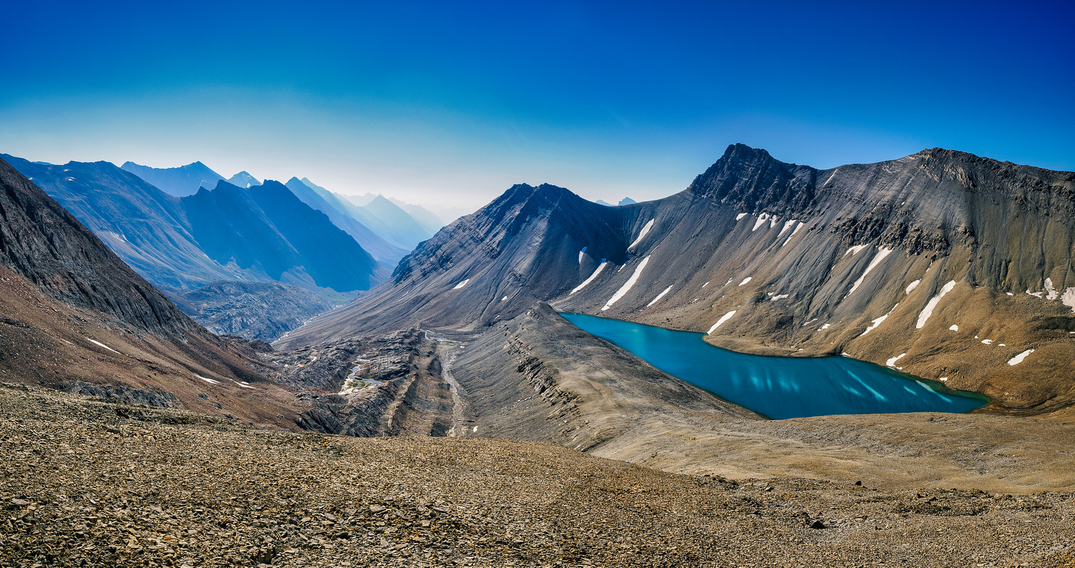
Somehow I slept worse on the 2nd night of our trip than the first. I’ve had this on big effort trips before. I think I’m pushing my body for so many hours in a row that by the 2nd night it’s overwhelmed and doesn’t rest easily or something. I’m not sure. We were up once again around 06:00 on Thursday and leaving our bivy site before 07:00 headed for Mount McDonald. McDonald was the only peak other than Afternoon that I’d had on my list for a few years already since reading Rick Collier’s report on bivouac.com. While researching it I right away noticed the huge alpine lake on its SE flanks that got me very excited to pay a visit.
After walking 3kms up McDonald Creek we once again dropped the overnight packs, shrugged into light day packs and went exploring an obscure summit that few have ever heard of much less desire to visit. My favorite kind of peak.
It was already 12:30 when we returned from a memorable ascent of Mount McDonald to our overnight packs along McDonald Creek. We had decided the day before that instead of returning all the way over the SE shoulder of Mount Willis to Nigel Pass we would instead continue up the Afternoon alpine meadows to “Oval Peak” (false Afternoon Peak) and exit via Ephraim’s GPS track that he’d generously shared with me before the trip. This track would lead us down Oval’s west slopes to the Brazeau River and the South Boundary Trail. The SBT would be our exit over Nigel Pass to the trailhead. But. There was still the camping issue. There was no way we could exit already on Thursday. Sara had done some mapping and math the evening before and concluded that to exit today would mean hiking close to 50km! That wasn’t going to happen – especially on the tail end of a trip that would see us ascend 5 peaks and walk over 100 kilometers in some bloody HOT and tiring weather, mostly off trail and with big packs! But. Where were we going to camp then?! Hmmm. Future Vern problem? Yes, but not THAT far into the future at this juncture.
The overnight packs felt heavy as we sweated and swore our way towards the north end of Mount Frances. The bushwhacking wasn’t terrible but the willows sure weren’t pleasant. By the time we finally got into the drainage proper I was seriously wondering what lay ahead for us. I was struggling a bit in the oppressive summer heat both mentally and physically at this point and so was Sara, I think.
As we hiked towards a very distant looking Oval Peak we chuckled at one of the register entries on Mount McDonald that mentioned a couple taking 8 days to backpack what we were planning to do in 3. And we did 2 or 3 more peaks than they did! I’m not saying they were slow or we were fast, I’m just saying that it explained some of our grumpy exhaustion at this point. They were arguably the smarter ones but then again 8 days of supplies is pretty heavy and I hate heavy backpacks almost more than anything else at this point in my life. I had Eph’s GPS track from his ascent of Mount Frances’ north ridge and we angled towards it in order to get on a good line to the north shoulder of Oval Peak. This resulted in some seriously nasty willow-whacking and more sweating and swearing. It’s not all unicorns and rainbows hiking for days off trail folks. Sometimes it’s just hard f’ing work and you suck it up and charge through those dang willows like a bull moose. (Or if you’re Sara, you swim and coax your way slowly through them in a much more dignified manner. )
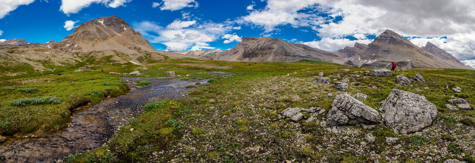
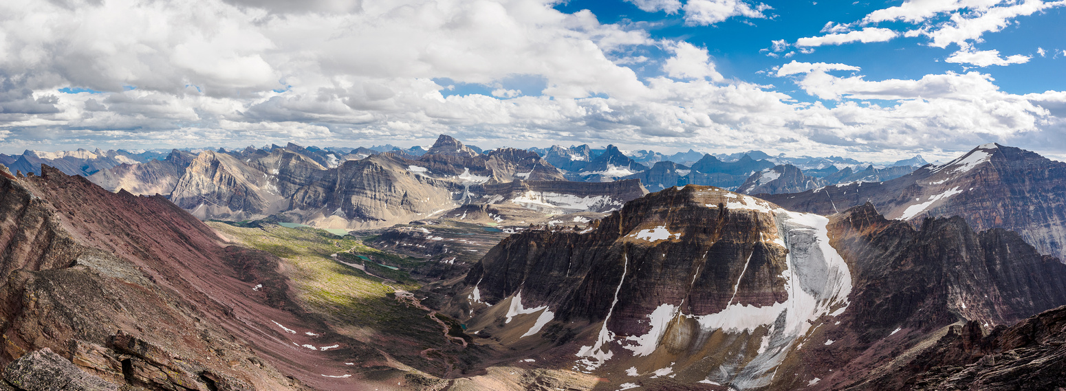
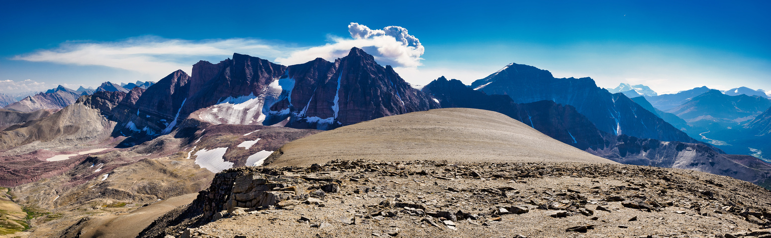
Finally we pushed through the last of problematic willows and started another fantastic hike through high alpine meadows. These meadows were much more typical Rockies ones with bear diggings, low vegetation and very little rock and slab. Although Oval Peak continued to look FAR away, we could glance back at Mount Frances growing smaller and know that we were making some progress. Afternoon Peak’s north face was incredible in the hazy summer air.
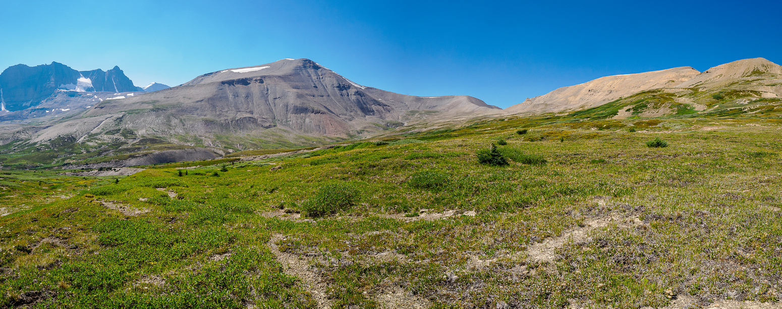
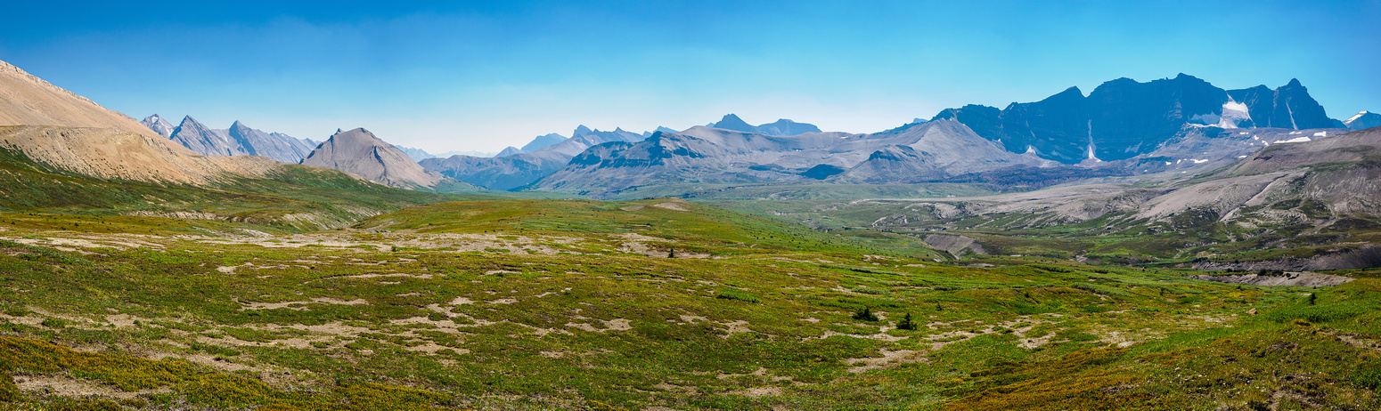
We choose the most efficient line we could towards a col between the north shoulder of Oval and an east outlier. The meadows were gorgeous the higher we got, including deep ravines holding clear, cold streams draining towards McDonald Creek. Just before the col we ended up on some strange sandy terrain that had us wondering if we’d suddenly transported to the Sahara desert. We followed old tracks up to the col and eyed the remained height gain to the north ridge of Oval just ahead. Once again, the hot summer sun was cooking some of the enjoyment out of us but the landscapes were so dang scenic it was very hard to stay grumpy about it for very long.
Now is when things get tragic, funny or a little of both depending who you are and your mood. We agreed that based on how we were feeling in the extreme heat and windless air, there was simply no way we could exit to the trailhead today. We’d have to camp somewhere and it would likely be in the park. I was very reluctant about staying in a campground. I really don’t like it when folks without reservations stay in designated and reserved sites but I was willing to overlook this unethical practice, provided we found open spots late in the evening. Or at least I thought I was ok with it… Because we had so much daylight left we decided to tag “Oval Peak” and spend some time doing it. We had daylight hours to burn! It was already 15:00 at this point – we’d taken almost 3 hours to traverse from our Mount McDonald exit to the north shoulder of Oval Peak.
After taking our time bagging the easy Oval Peak, Sara and I turned our sights on the descent from the north shoulder we were on to the Brazeau River valley far below. Very grateful to have Ephraim Roberts’ GPS track, we ambled slowly down steep scree and grass slopes into a drainage NW of Oval. Following the GPS track and the odd sheep trail we got easily down to treeline.

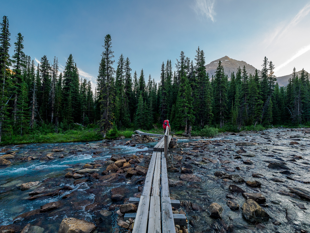
I wasn’t sure what we’d encounter from treeline to the Brazeau River but it was far better than expected thanks again to Eph’s GPS track. We followed his descent line as best as we could, avoiding thicker bush where possible and charging through it where not. It was a highlight moment when we finally stumbled on a horse trail leading south to the large bridge we’d spotted from Oval Peak already. In a strange twist it was very quickly a lowlight moment when we lost the old hiker’s trail about 200m before the bridge and ended up in a thick swamp with a billion mosquitoes fighting for our blood. That really sucked! (Haha.) The bridge was strangely large, considering it kind of leads to nowhere for hikers. Horses cross at a different spot further downstream and if I ever went back to this trail I’d consider crossing there too – forgoing the bridge in order to stay on a decent trail.
It was now 19:00 and the sun was already getting low in the sky as we crossed the bridge to join the South Boundary Trail. We’d hiked almost 30km already, all of it off trail. We’d ascended two peaks and much more terrain with our overnight packs under a blistering hot summer sun and we were feeling it. Now there were a billion mossies vying for our blood and we were tired, a bit grumpy and totally worn out. But there was really no place to set up a camp near the bridge so we decided to put on bug spray and march 4.5kms up the SBT to the Four Point Campground and hope for a couple of open tent sites. I had my doubts about finding spots, but we started walking and soon were back in the easy rhythms of hiking on a trail again. As we walked I gave Sara some options in case there was only one spot available. I told her I was willing to walk to the parking lot if she wanted to camp – I had no issue with that at all. Over the years I’ve gotten very nervous about camping without a permit in the national parks. I don’t need an example to be made of me like I know has been done to others with an Internet presence. I also really don’t like the idea of someone with a reservation coming late to a campground only to find a jerk like me in their spot. That’s really uncool in my opinion and not fair at all.
The evening light over the Brazeau River valley was gorgeous as we walked towards Four Point. The sun was almost setting as we walked into a busy camp. I noticed right away that there was an open spot but we backed off, unsure what exactly we should do. Site 7 was off to the side and we hiked there only to find it also empty. So we could stay and risk stealing someone else’s spot but should we? Sara could tell I didn’t like this option at all. She was right. After discussing it and getting some honest opinions we realized that I really wanted to complete the hike to the parking lot today rather than camp illegally along one of the busiest trails in Jasper National Park. Sara was willing to do the death march but not entirely happy about it. We ate something before putting the packs back on. It was going to be a long night! It was around 20:00 as we slowly began the hike to the Boulder Creek Campground – our last shot at camping before the trailhead. It was not to be – we were going to exit today. As we marched past the Boulder Creek Camp we encountered a surprised camper holding a birthday cake for her partner. Boy did that cake look good. I almost grabbed a piece as she sidled past us with a wary sideways glance at our scruffy appearance.
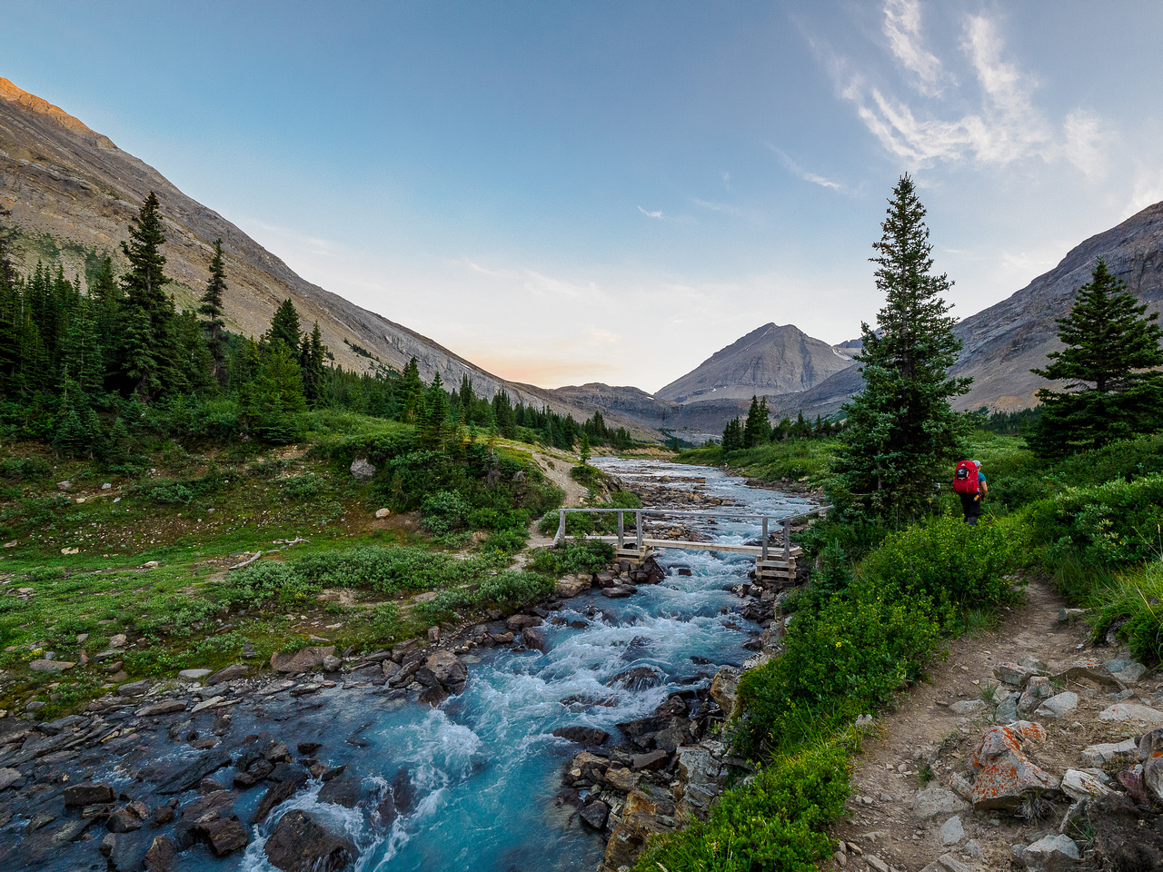
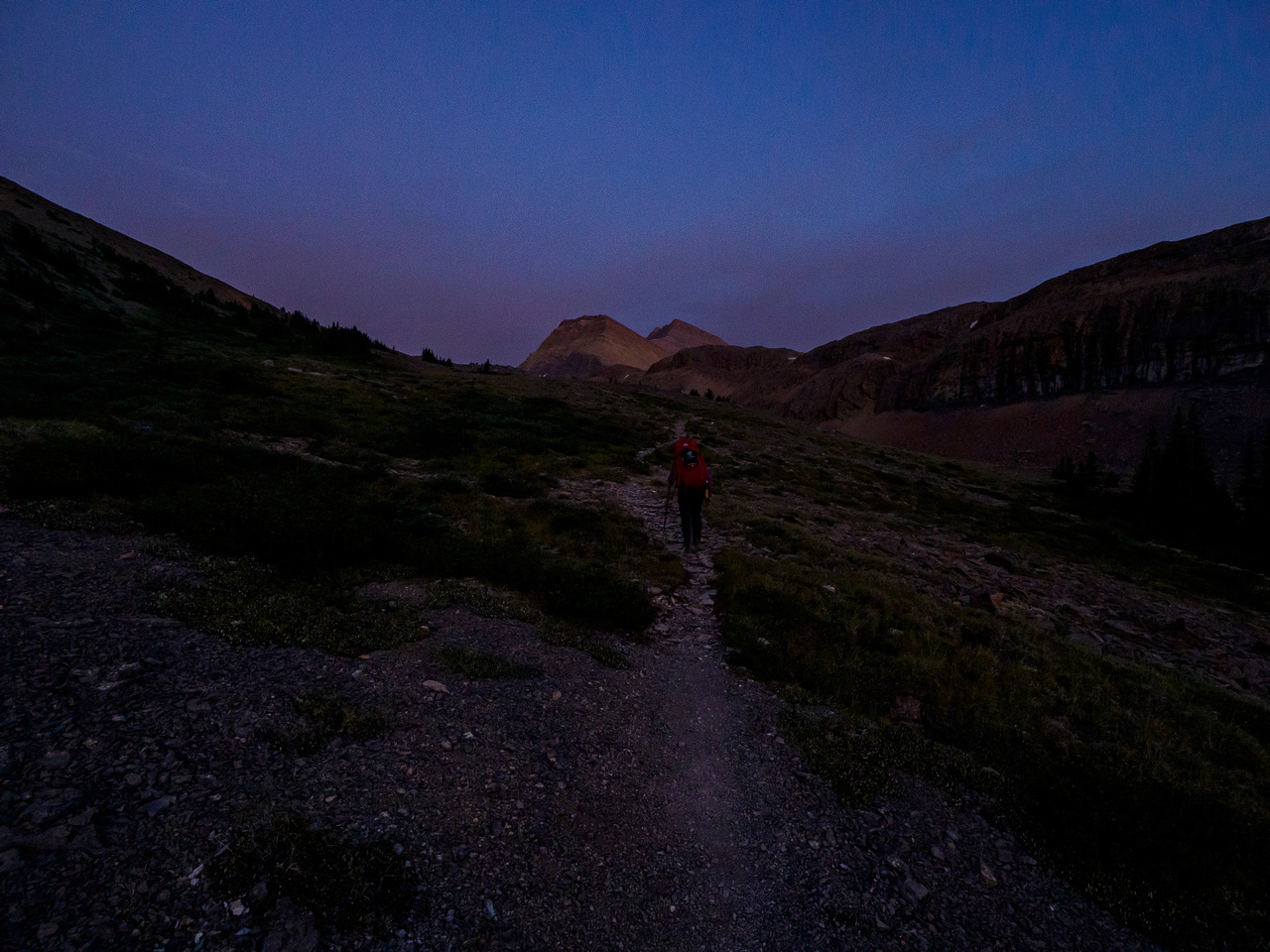
We took our last break at the bridge over the Brazeau River just past the Boulder Creek Campground as the sun set over Nigel Pass and the surrounding peaks. It was now 21:00 and we were sore. Damn sore. We were surprisingly chipper as we passed a sign letting us know it was ‘only’ 10.9 kilometers to the Nigel Pass trailhead. Less than 11 kms? Bah humbug. Not even worth worrying about right? Well… Sort of and sort of not. The next 3 kms of hiking were pretty rough in growing darkness. Having never hiked up Nigel Pass from the Boulder Creek side before, it was a helluva grunt! We gained hundreds of meters with big packs digging into our shoulders and our feet screaming protest at the additional abuse we were subjecting them to. A few times I had to stop and breathe through the pain in my big toes – I could feel the skin tearing off of them. I was worried that if I stopped at this point there was no carrying on so I bore through the pain and kept going. Sara had already been suffering for hours with very sore feet and suffered on in silence. Headlamps came on as we worked our way up the pass and the evening became night. Finally at 22:00 we crested the pass and joined with our approach track.
I’m not going to sugarcoat the last few hours to the trailhead. They were freaking tough. We both had to dig very deep to continue onwards in the dark, one foot in front of the other for kilometer after kilometer on a hardpack and uneven trail. I was amused to realize when I got home that I was reading Stephen King’s “Long Walk” at the time of both my 47km and 49km walks on Bonnet and this trip. Related? I’m not sure, but I think so. I should sue Mr. King for putting ideas into my head! The final 2 kms from the Nigel Creek crossing up the hardpack old hwy to the trailhead was pure hell on earth. There’s no other way to put it. Poor Sara couldn’t even walk at half her normal pace, she was in so much pain at this point. My feet were numb which helped me walk a bit quicker than her. Finally, at 23:45 we stumbled into the parking lot, 17 hours and 49 kilometers from our bivy along McDonald Creek.
What a day! I don’t need to repeat THAT every time I visit the Rockies. As I close off this extensive trip report a few weeks after completing it, I am struck again by the remoteness of the terrain we traveled and the amount of work we did over three very long and hot days. I will be remembering this trip for many years – and even though some of the memories will be painful, mostly they will be incredibly positive. I’ve said it before but it bears a repeat. We are so extremely lucky to live in a free and beautiful country such as Canada. We should all try hard to recognize this and carry it forward into our day-to-day lives. Otherwise what’s the point of all these grand adventures and incredible experiences? I highly recommend this area for experienced mountain trekkers. I only recommend taking a few more days to do it than we did if you can.
Two weeks later, my poor feet are almost back to normal…
😬