
Summit Elevation (m): 2938, 2630
Trip Date: Saturday, August 6, 2005
Round Trip Time (hr): 9
Elevation Gain (m): 1600
Total Trip Distance (km): 19
Quick ‘n Dirty Rating: Class 4 – you fall, you break something or worse
Difficulty Notes: A fall on the crux of Smuts would severely injure or kill so take necessary precautions. Adding The Fist does make for a long day but the Fist is much easier than Smuts.
Technical Rating: SC7
GPS Track: Gaia
Map: Google Maps
Photos: View Album
On an early (04:30) August 6 2005 morning, I joined Dave Stephens and Blair Piggot on a full day trip to scramble Mount Smuts and The Fist in Kananaskis Country. Blair and Dave do a lot of mountaineering and climbing trips together and every once in a while Dave manages to sucker Blair into a scramble. Dave and I were turned back from summitting Smuts on July 23rd when a strong wind and impending storm forced us to rappel back down the ridge after making it about 1/4 way up the ‘tough stuff’.


There was a reason why Dave and I really wanted to make the summit of Smuts and that was to place the memorial cairn for Van Belliveau who who tragically fell to his death from the summit of Smuts a few weeks earlier.

Mount Smuts has always made me more than a little nervous. The way Kane describes this mountain it’s a ‘climbers scramble’ and ‘exhilarating’. I love the whole ‘exhilarating’ thing but the climbing thing always made me a bit nervous. Lately some people have been posting reports about scrambling Smuts and reading them didn’t help my apprehension any! I knew after our unsuccessful attempt that the ridge wasn’t as bad as I had made it out to be in my head. I also knew that the super-exposed section of the ridge wasn’t nearly as long as I had originally thought.
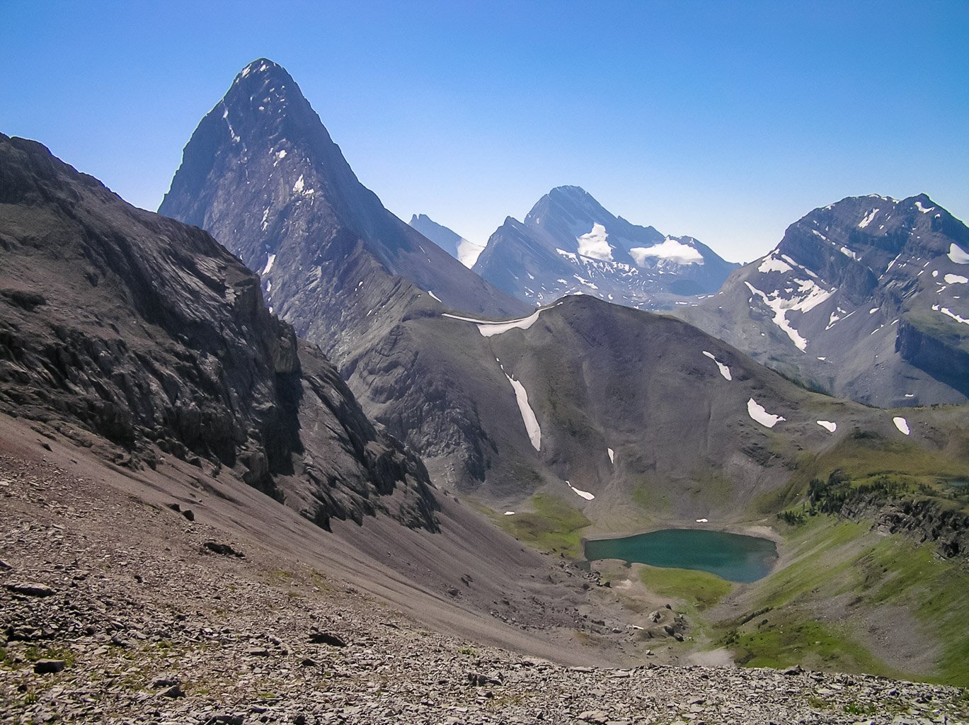
Mount Smuts
Saturday morning was a clear and windless one and as we biked from the trailhead we were in good spirits. After ditching the bikes almost 3 km in we realized that we could have biked a bit further (to the first falls) but oh well! We quickly made our way along the trail to Smuts Pass and just before the climb to the pass we met up with Bill Kerr and Gary Vandergrift. After quick introductions we continued on and following Blair’s blistering pace we were on top of the pass only just over an hour from the parking lot! Blair apparently doesn’t believe in the need to stop and catch your breath – he just motored all the way up to the pass with 1.5 stops.

We stopped for a quick snack and drink and then pressed on up the scree slope to the ribs that lead up to the ridge. Right away Dave and I knew that this would be a much better day than two weeks ago. The rock was dry and we could stay to the right of the gully on the slabs which made for quick and fun scrambling. (In other words if you are attempting Smuts and you can’t climb the ribs along the climbers right of the gully don’t even bother continuing!) Once again, Blair kicked our butts up the mountain and eventually Dave and I joined him on the ridge. My strategy was clear in my head. I already knew the route to the second rap station and from there I was going to go straight up. When I got to the crack that forced the Nugara brothers to go further left I was going to go right. (Kane’s route picture shows the route always going to the right.)


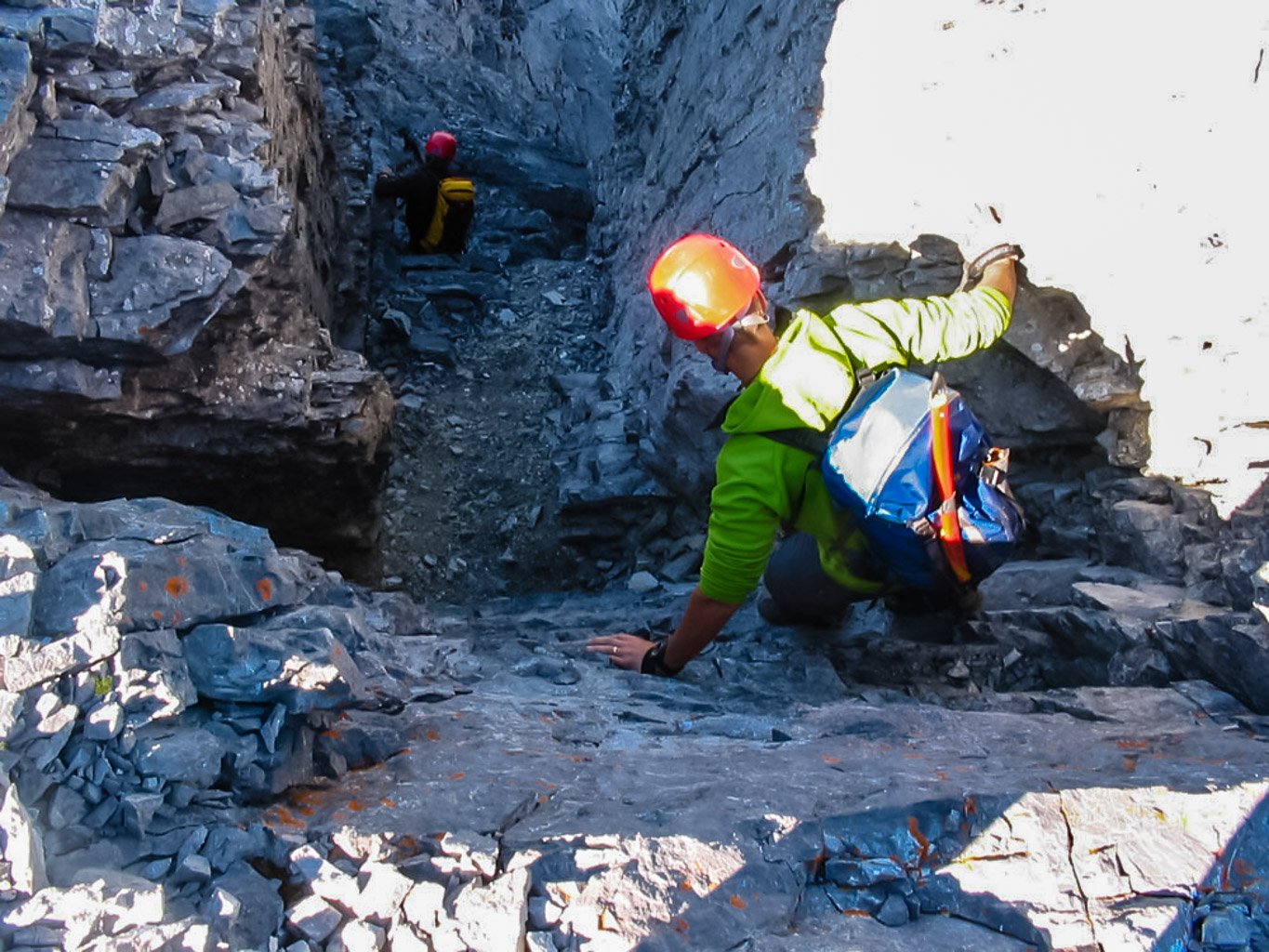
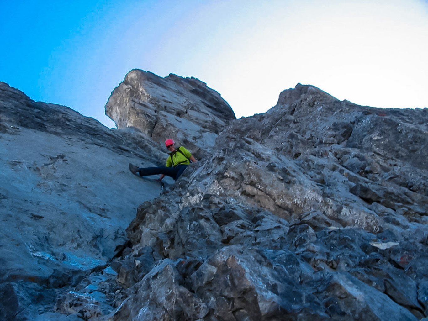
Without waiting any longer I started up. The rock was dry, the sun was warm on my face and the breeze was light. I never stopped until I recognized the spot where I was planning to go off to the right. There are actually two cracks here. To get to the right-hand one you have to carefully work your way down a sloping ledge and than climb up the crack. This crack was steep and obviously exposed but I found the rock to be solid and in no time at all I was at the crux – an east-sloping slab that required some friction climbing to navigate up. After this bit of exhilaration I let out a whoop of relief and quickly scrambled up the rest of the nasty stuff till I knew I was onto easier terrain.


I apparently went up the ridge very fast. Dave and Blair were nowhere to be seen and they told me later that other than the occasional whoop of excitement from above them they never really saw me till we met on the final summit ridge! I waited for a bit till I could spot Dave and Blair negotiating the tricky slab. I took some pretty cool pictures of the event and soon they caught up with me. Blair told me that since I was in some sort of groove I better keep going to the summit so I quickly took off and was soon standing on top of the infamous Mount Smuts about 2.5 hours after leaving the parking lot.


Dave and Blair joined me at the summit and we proceeded to build Van’s memorial cairn. Once I saw the summit area it became obvious where Van had slipped down the west face. There is an area behind the summit cairn that has a short, very steep scree slope which ends in the 400 meter cliff down the west face – any slip in this area would be fatal. After saying a few words for Van we placed his memorial in the cairn and were ready to start down.


The alternate descent is not easy. After the ridge we were kind of expecting the descent to be a trivial matter but of course it isn’t or everyone would simply scramble up to the summit this way. It was a very loose, very steep gully that (in Blair’s words) cause some puckering every once in a while.


Eventually we made it out and after traversing slabby terrain we were on the easy slopes curving back to Smuts Pass. Since we hadn’t had enough difficult scrambling for the day (!!) we decided that it was time to bag The Fist while we were in the area anyway.

The Fist
After scrambling Mount Smuts Dave, Blair and I figured that we should tack on another difficult scramble just to make sure our day was filled up. We circled all the way around Mount Smuts after descending it’s harrowing gully and side-sloped for what seemed like hours till we finally came to the Smuts / Fist col. Actually it did take us quite a while to do the hike around Smuts and to The Fist. There were sections of nasty bushwhacking and sections of really bad side-sloping and even some pretty slick snow we had to cross. It took us 3 hours to go from the summit of Smuts to the Fist / Smuts col while going all the way from the parking lot to the summit of Smuts only took me 2.5 hours.

We met up with a group of climbers from Edmonton at the Smuts / Fist col just after they came off The Fist. After chatting for a bit we headed for the ascent gully. The climb up the ascent gully was fun but a lot looser than Smuts. It was also a lot less exposed but a slip still would have hurt a bit.


Rockfall was the main concern in the gully – but be forewarned, it is a steep endeavor and not to be taken too lightly. I wouldn’t even consider trying it without a helmet and certainly not if anyone else was in the gully already.

Eventually we popped out of the gully and navigated some really exposed terrain to get to the summit. While Blair searched out some exposed stuff to fool around on, Dave and I sucked in the views and as much liquids as we could. We didn’t stay at the summit for long and soon were dumping rocks on each other down the gully.


Other than one tense moment when Dave put all his weight on the exact rock I had just told him was loose and sent 50 lbs of rock crashing down over my hand and just past Blair (he thought I meant the OTHER one) – we made it down with no major incidents. I’m sure glad I am 6ft tall because some of the down climbing in the gully was a lot easier for someone with good reach! If you’re not used to very steep and loose terrain and you haven’t just done Smuts I think you could find this scramble quite difficult in places. It kind of reminded me a bit of the upper part of Dolomite Peak.

Once we made it back to the col we spent the next hour bushwhacking our way down to the trail and out to our bikes. I was surprised that there was no trail down from the col but I think we might have done better by traversing further south before cutting down.


Bikes are really nice after a long, hot day of walking and we were at the parking lot in no time flat. Round trip time was just under 9 hours.